Saint-Salvy
Saint-Salvy ist eine französische Gemeinde mit 201 Einwohnern (Stand 1. Januar 2019) im Département Lot-et-Garonne in der Region Nouvelle-Aquitaine (vor 2016 Aquitaine). Die Gemeinde gehört zum Arrondissement Agen und zum Kanton Le Confluent (bis 2015 Port-Sainte-Marie).
| Saint-Salvy | ||
|---|---|---|
| ||
| Staat | Frankreich | |
| Region | Nouvelle-Aquitaine | |
| Département (Nr.) | Lot-et-Garonne (47) | |
| Arrondissement | Agen | |
| Kanton | Le Confluent | |
| Gemeindeverband | Confluent et Coteaux de Prayssas | |
| Koordinaten | 44° 18′ N, 0° 26′ O | |
| Höhe | 63–184 m | |
| Fläche | 9,33 km² | |
| Einwohner | 201 (1. Januar 2019) | |
| Bevölkerungsdichte | 22 Einw./km² | |
| Postleitzahl | 47360 | |
| INSEE-Code | 47275 | |
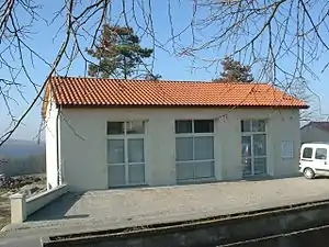 Rathaus (Mairie) von Saint-Salvy | ||

Geografie
Saint-Salvy liegt etwa 20 Kilometer westnordwestlich von Agen. Umgeben wird Saint-Salvy von den Nachbargemeinden Bourran im Norden und Nordwesten, Lacépède im Norden und Nordosten, Prayssas im Osten, Frégimont im Süden, Bazens im Süden und Südwesten sowie Galapian im Westen.
Bevölkerungsentwicklung
| Jahr | Einwohner | |||||||
|---|---|---|---|---|---|---|---|---|
| 1962 | 219 | |||||||
| 1968 | 177 | |||||||
| 1975 | 171 | |||||||
| 1982 | 155 | |||||||
| 1990 | 166 | |||||||
| 1999 | 187 | |||||||
| 2006 | 196 | |||||||
| 2013 | 179 | |||||||
| Quelle: Cassini und INSEE | ||||||||
This article is issued from Wikipedia. The text is licensed under Creative Commons - Attribution - Sharealike. The authors of the article are listed here. Additional terms may apply for the media files, click on images to show image meta data.