Osrednjeslovenska
Osrednjeslovenska (deutsch Zentralslowenien), präzise Osrednjeslovenska regija ist eine statistische Region in Slowenien auf NUTS3-Ebene.
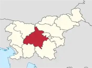
Die Region, die für statistische Zwecke bestimmt ist, wurde im Mai 2005 eingeführt. Sie umfasst insgesamt 26 Gemeinden. Die größte Stadt ist Ljubljana. Die Gesamtfläche beträgt 2.487 km².[1] Die Einwohnerzahl am 1. Januar 2014 betrug 546.314.[2]
2015 wurde die Gemeinde Litija aus der Region Osrednjeslovenska zur Region Zasavska umgegliedert.[3]
| Wappen | Gemeinde | Deutscher Name | Karte | Fläche km² |
Einwohner (1. Januar 2014) |
Ew./ km² |
NUTS3- Code |
|---|---|---|---|---|---|---|---|
| Borovnica | Franzdorf | 42,3 | 4.153 | 98 | SI021 | ||
| Brezovica | Bresowitz | 91,2 | 11.761 | 129 | SI021 | ||
| Dobrepolje | Gutenfeld | 94,9 | 3.954 | 42 | SI021 | ||
| Dobrova-Polhov Gradec | Dobrawa-Billichgrätz | 117,5 | 7.485 | 64 | SI021 | ||
| Dol pri Ljubljani | Lustthal | 33,3 | 5.777 | 173 | SI021 | ||
| Domžale | Domschale | 72,3 | 34.753 | 481 | SI021 | ||
| Grosuplje | Grosslup | 133,8 | 19.842 | 148 | SI021 | ||
| Horjul | Baumkirch | 32,5 | 2.937 | 90 | SI021 | ||
| Ig | Igglack | 98,8 | 7.046 | 71 | SI021 | ||
| Ivančna Gorica | Johannsbüchel | 227,0 | 15.963 | 70 | SI021 | ||
| Kamnik | Stein in Oberkrain | 265,6 | 29.385 | 111 | SI021 | ||
| Komenda | Kappelsdorf | 24,1 | 5.868 | 243 | SI021 | ||
| Ljubljana | Laibach | 275,0 | 285.857 | 1.039 | SI021 | ||
| Logatec | Loitsch | 173,1 | 13.703 | 79 | SI021 | ||
| Log-Dragomer | Dragomer | 11,0 | 3.620 | 329 | SI021 | ||
| Lukovica | Lukowitz | 74,9 | 5.631 | 75 | SI021 | ||
| Medvode | Zwischenwassern | 77,6 | 15.868 | 204 | SI021 | ||
| Mengeš | Mansburg | 22,5 | 7.579 | 337 | SI021 | ||
| Moravče | Moräutsch | 61,4 | 5.173 | 84 | SI021 | ||
| Škofljica | Frauenberg | 43,3 | 9.988 | 231 | SI021 | ||
| Šmartno pri Litiji | Sankt Martin | 23,8 | 5.476 | 230 | SI021 | ||
| Trzin | Tersein | 8,6 | 3.851 | 448 | SI021 | ||
| Velike Lašče | Großlaschitz | 103,2 | 4.206 | 41 | SI021 | ||
| Vodice | Woditz | 31,4 | 4.820 | 154 | SI021 | ||
| Vrhnika | Oberlaibach | 126,3 | 16.564 | 131 | SI021 | ||
| Gesamt |
Einzelnachweise
- Territorial units and house numbers by the municipalities, Slovenia, quarterly, www.stat.si, englisch, abgerufen am 1. August 2014
- SI-STAT
- Namens- und Gebietsänderungen bei NUTS 3 ab 2015 (Memento vom 17. November 2014 im Internet Archive), www.stat.si, englisch, abgerufen am 28. Juli 2014

Städte: Domžale | Ljubljana | Logatec. Gemeinden: Borovnica | Brezovica | Dobrepolje | Dobrova-Polhov Gradec | Dol pri Ljubljani | Grosuplje | Horjul | Ig | Ivančna Gorica | Kamnik | Komenda | Log-Dragomer | Lukovica | Medvode | Mengeš | Moravče | Škofljica | Šmartno pri Litiji | Trzin | Velike Lašče | Vodice | Vrhnika