Savinjska
Savinjska (slowenisch: Savinjska statistična regija) ist eine statistische Region in Slowenien auf NUTS3-Ebene.
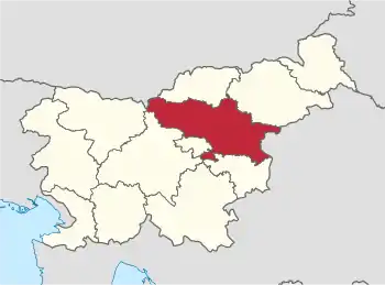
Die Region, die für statistische Zwecke bestimmt ist, wurde im Mai 2005 eingeführt. Sie umfasst derzeit 33 Gemeinden. Die größte Stadt in der 2.384 km²[1] großen Region ist Celje. Die Einwohnerzahl am 1. Januar 2014 betrug 259.853.[2]
Die Region Savinjska wurde ab 2015 um die beiden Gemeinden Radeče und Bistrica ob Sotli verkleinert, diese werden in die dann umbenannte Statistische Region Posavska umgegliedert.[3]
| Wappen | Gemeinde | Deutscher Name | Karte | Fläche km² |
Einwohner (1. Januar 2014) |
Ew./ km² |
NUTS3- Code |
|---|---|---|---|---|---|---|---|
| Braslovče | Fraßlau | 55,0 | 5.442 | 99 | SI014 | ||
| Celje | Cilli | 94,9 | 48.868 | 515 | SI014 | ||
| Dobje | Dobje bei Montpreis | 17,5 | 968 | 55 | SI014 | ||
| Dobrna | Neuhaus | 31,7 | 2.215 | 70 | SI014 | ||
| Gornji Grad | Oberburg | 90,1 | 2.628 | 29 | SI014 | ||
| Kozje | Drachenburg | 89,7 | 3.114 | 35 | SI014 | ||
| Laško | Tüffer | 197,5 | 13.327 | 67 | SI014 | ||
| Ljubno | Laufen | 78,9 | 2.621 | 33 | SI014 | ||
| Luče | Leutsch | 109,5 | 1.492 | 14 | SI014 | ||
| Mozirje | Prassberg | 53,5 | 4.103 | 77 | SI014 | ||
| Nazarje | Nazareth | 43,4 | 2.573 | 59 | SI014 | ||
| Podčetrtek | Windisch Landsberg | 60,6 | 3.318 | 55 | SI014 | ||
| Polzela | Heilenstein | 34,0 | 6.060 | 178 | SI014 | ||
| Prebold | Pragwald | 40,6 | 5.002 | 123 | SI014 | ||
| Rečica ob Savinji | Riez | 30,1 | 2.338 | 78 | SI014 | ||
| Rogaška Slatina | Rohitsch-Sauerbrunn | 71,5 | 10.981 | 154 | SI014 | ||
| Rogatec | Rohitsch | 39,6 | 3.115 | 79 | SI014 | ||
| Slovenske Konjice | Gonobitz | 97,8 | 14.453 | 148 | SI014 | ||
| Solčava | Sulzbach | 102,8 | 523 | 5 | SI014 | ||
| Šentjur pri Celju | Sankt Georgen bei Cilli | 222,3 | 18.922 | 85 | SI014 | ||
| Šmarje pri Jelšah | St. Marein bei Erlachstein | 107,7 | 10.214 | 95 | SI014 | ||
| Šmartno ob Paki | St. Martin a. d. Pack | 18,2 | 3.223 | 177 | SI014 | ||
| Šoštanj | Schönstein | 95,6 | 8.806 | 92 | SI014 | ||
| Štore | Store | 28,1 | 4.250 | 151 | SI014 | ||
| Tabor | Tabor | 34,8 | 1.620 | 47 | SI014 | ||
| Velenje | Wöllan | 83,5 | 32.973 | 395 | SI014 | ||
| Vitanje | Weitenstein | 59,4 | 2.235 | 38 | SI014 | ||
| Vojnik | Hochenegg | 75,3 | 8.537 | 113 | SI014 | ||
| Vransko | Franz | 53,3 | 2.597 | 49 | SI014 | ||
| Zreče | Rötschach | 67,0 | 6.358 | 95 | SI014 | ||
| Žalec | Sachsenfeld | 117,1 | 21.255 | 182 | SI014 | ||
| Gesamt |
Einzelnachweise
- Territorial units and house numbers by the municipalities, Slovenia, quarterly, www.stat.si, englisch, abgerufen am 1. August 2014
- SI-STAT
- Artikel zur Namens- und Gebietsänderungen bei NUTS 3 ab 2015 (Memento vom 17. November 2014 im Internet Archive), www.stat.si, englisch, abgerufen am 28. Juli 2014.

Städte: Celje Rogaška Slatina | Slovenske Konjice | Šoštanj | Velenje. Gemeinden: Braslovče | Dobje | Dobrna | Gornji Grad | Kozje | Laško | Ljubno | Luče | Mozirje | Nazarje | Podčetrtek | Polzela | Prebold | Rečica ob Savinji | Rogatec | Šentjur | Šmarje pri Jelšah | Šmartno ob Paki | Solčava | Štore | Tabor | Vitanje | Vojnik | Vransko | Žalec | Zreče