Montreuil-aux-Lions
| Montreuil-aux-Lions | ||
|---|---|---|
.svg.png.webp)
|
| |
| Staat | Frankreich | |
| Region | Hauts-de-France | |
| Département (Nr.) | Aisne (02) | |
| Arrondissement | Château-Thierry | |
| Kanton | Essômes-sur-Marne | |
| Gemeindeverband | Canton de Charly-sur-Marne | |
| Koordinaten | 49° 1′ N, 3° 12′ O | |
| Höhe | 65–214 m | |
| Fläche | 12,99 km² | |
| Einwohner | 1.364 (1. Januar 2019) | |
| Bevölkerungsdichte | 105 Einw./km² | |
| Postleitzahl | 02310 | |
| INSEE-Code | 02521 | |
| Website | http://www.montreuilauxlions.fr/ | |
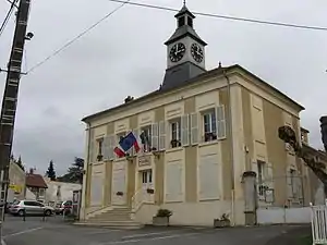 Rathaus von Montreuil-aux-lions | ||

Montreuil-aux-Lions ist eine französische Gemeinde mit 1.364 Einwohnern (Stand: 1. Januar 2019) im Département Aisne in der Region Hauts-de-France. Die Gemeinde gehört zum Arrondissement Château-Thierry und ist Teil des Kantons Essômes-sur-Marne.
Geografie
Montreuil-aux-Lions liegt etwa 65 Kilometer ostnordöstlich von Paris. Umgeben wird Montreuil-aux-Lions von den Nachbargemeinden Marigny-en-Orxois im Norden und Nordosten, Bézu-le-Guéry im Osten und Südosten, Sainte-Aulde im Süden und Südwesten sowie Dhuisy im Westen.
Durch die Gemeinde führt die Autoroute A4.
Bevölkerungsentwicklung
| Jahr | 1962 | 1968 | 1975 | 1982 | 1990 | 1999 | 2006 | 2013 |
| Einwohner | 585 | 585 | 630 | 701 | 1.001 | 1.197 | 1.333 | 1.384 |
| Quelle: Cassini und INSEE | ||||||||
Sehenswürdigkeiten
_%C3%89glise_1.jpg.webp)
Kirche Saint-Martin
- Kirche Saint-Martin aus dem 13. Jahrhundert, seit 1921 Monument historique
- Kommanderie des Tempelritterordens
- Britischer Militärfriedhof
This article is issued from Wikipedia. The text is licensed under Creative Commons - Attribution - Sharealike. The authors of the article are listed here. Additional terms may apply for the media files, click on images to show image meta data.