Liste der Landschaftsschutzgebiete im Landkreis Lüchow-Dannenberg
Die Liste der Landschaftsschutzgebiete im Landkreis Lüchow-Dannenberg enthält die Landschaftsschutzgebiete des Landkreises Lüchow-Dannenberg in Niedersachsen.
| Bild | Nummer | Bezeichnung des Gebietes | Fläche in Hektar | WDPA-ID | Koordinaten[1] | Datum der Verordnung |
|---|---|---|---|---|---|---|
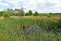
| LSG DAN 00005 | Jagen 21 im Gartower Forst | 23,00 | 321987 | Position | 1939 | |
 |
LSG DAN 00007 | Alter Friedhof Dannenberg | 0,20 | 319547 | Position | 1939 |
| LSG DAN 00010 | Toter Jeetzelarm | 0,10 | 325210 | Position | 1939 | |
 |
LSG DAN 00011 | Eichenmischwald Lisei | 35,00 | 320550 | Position | 1939 |
| LSG DAN 00015 | Sandberg | 3,00 | 324079 | Position | 1941 | |
 |
LSG DAN 00026 | Langendorfer Berg | 2135,00 | 322505 | Position | 1974 |
 |
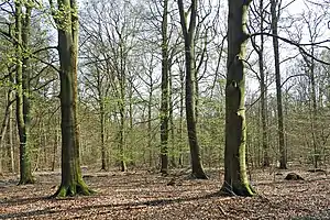
LSG DAN 00027 | Elbhöhen-Drawehn | 37101,00 | 320585 | Position | 1974 |
| LSG DAN 00028 | Gain - Mühlenbach - obere Dummeniederung | 542,30 | 320944 | Position | 1974 | |
| LSG DAN 00029 | Püggener Moor | 300,00 | Position | 1974 | ||
 |
LSG DAN 00030 | In der Elbmarsch | 33,00 | 321920 | Position | 1974 |
 |
LSG DAN 00032 | Konau bei Braudel | 46 | Position | 2019 |
Anmerkungen
- Koordinaten wurden dem European Nature Information System (EUNIS) der Europäischen Umweltagentur entnommen: Nationally designated areas (CDDA), Datei CDDA_v12_csv.zip, Stand Oktober 2014. Die Tabellenspalte WDPA-ID gibt die genauen Grenzen an.
Siehe auch
Weblinks
Ammerland | Aurich | Braunschweig | Celle | Cloppenburg | Cuxhaven | Delmenhorst | Diepholz | Emden | Emsland | Friesland | Gifhorn | Goslar | Göttingen | Grafschaft Bentheim | Hameln-Pyrmont | Region Hannover | Harburg | Heidekreis | Helmstedt | Hildesheim | Holzminden | Leer | Lüchow-Dannenberg | Lüneburg | Nienburg/Weser | Northeim | Oldenburg (Land) | Oldenburg (Stadt) | Osnabrück (Land) | Osnabrück (Stadt) | Osterholz | Peine | Rotenburg (Wümme) | Salzgitter | Schaumburg | Stade | Uelzen | Vechta | Verden | Wesermarsch | Wilhelmshaven | Wittmund | Wolfenbüttel | Wolfsburg
This article is issued from Wikipedia. The text is licensed under Creative Commons - Attribution - Sharealike. The authors of the article are listed here. Additional terms may apply for the media files, click on images to show image meta data.