Liste der Landschaftsschutzgebiete im Landkreis Goslar
Die Liste der Landschaftsschutzgebiete im Landkreis Goslar enthält die Landschaftsschutzgebiete des Landkreises Goslar in Niedersachsen.
| Bild | Nummer | Bezeichnung des Gebietes | Fläche in Hektar | WDPA-ID | Koordinaten[1] | Datum der Verordnung |
|---|---|---|---|---|---|---|
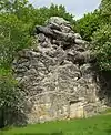 |
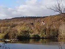
LSG GS 00001 | Ruinen auf dem Petersberg einschließlich Klusfelsen | 3,00 | 324037 | Position | 1937 |
.jpg.webp) |
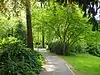
LSG GS 00002 | Grauhöfer Holz | 155,00 | 321148 | Position | 1942 |
 |
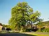
LSG GS 00006 | Sudmerberg | 150,00 | 324922 | Position | 1966 |
.jpg.webp) |
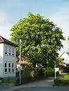
LSG GS 00007 | Kattenberg | 7,00 | 322071 | Position | 1966 |
.jpg.webp) |
LSG GS 00008 | Grauhöfer Landwehr | 4,00 | 321149 | Position | 1966 |
.jpg.webp) |
LSG GS 00009 | Gutspark Riechenberg | 4,00 | 321281 | Position | 1966 |
.jpg.webp) |
LSG GS 00010 | Friedhof und Gutswald des Gutes Ohlhof | 6,00 | 320906 | Position | 1966 |
.jpg.webp) |
LSG GS 00011 | Friedhof des Klostergutes Grauhof | 0,30 | 320902 | Position | 1966 |
.jpg.webp) |
LSG GS 00012 | Friedhof an der Hildesheimer Straße | 12,90 | 320898 | Position | 1966 |
.jpg.webp) |
LSG GS 00013 | Neuer Friedhof an der Feldstraße | 6,00 | 323187 | Position | 1966 |
.jpg.webp) |
LSG GS 00014 | Jüdischer Friedhof | 0,20 | 322009 | Position | 1966 |
.jpg.webp) |
LSG GS 00015 | Georgenbergruine einschließlich des gesamten Baumbestandes | 0,70 | 321057 | Position | 1966 |
 |
LSG GS 00016 | Klostergarten Neuwerk mit Baumbestand | 1,50 | 322209 | Position | 1966 |
| LSG GS 00017 | Baumbestand im „Schönen Garten“ | 0,00 | 319824 | Position | 1966 | |
| LSG GS 00018 | Baumbestand der Thomasstraße | 0,00 | 319822 | Position | 1966 | |
.jpg.webp) |
LSG GS 00019 | Baumbestand des Stephanigartens | 0,00 | 319823 | Position | 1966 |
.jpg.webp) |
LSG GS 00020 | Baumbestand im Klubgarten | 0,00 | 319825 | Position | 1966 |
.jpg.webp) |
LSG GS 00024 | Pappel-, Eichen- und Buchenbestand an der Wachtelpforte | 0,00 | 323616 | Position | 1966 |
.jpg.webp) |
LSG GS 00025 | Baumbestand zwischen dem „Oberen Triftweg“ und der „Von-Garßen-Straße“ | 0,00 | 319828 | Position | 1966 |
 |
LSG GS 00026 | Roßkastaniengruppe | 0,00 | 323960 | Position | 1966 |
 |
LSG GS 00027 | Roßkastaniengruppe | 0,00 | 323959 | Position | 1966 |
| LSG GS 00037 | Bauerngehölz Lah | 6,20 | 319803 | Position | 1976 | |
 |
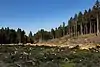
LSG GS 00039 | Harly | 493,00 | 321387 | Position | 1966 |
.jpg.webp) |
LSG GS 00040 | Salzgitterscher Höhenzug | 2127,80 | 324073 | Position | 1966 |
 |
LSG GS 00041 | Wallmodener Berge, Appelhorn-Bredelemer Holz | 1754,70 | 325641 | Position | 1966 |
| LSG GS 00042 | Nettetal Oberes Nettetal[2] |
336,00 | 323383 | Position | 1967 | |
| LSG GS 00043 | Luttertal | 32,10 | 322870 | Position | 1967 | |
| LSG GS 00044 | Wohldenstein | 19,40 | 325928 | Position | 1967 | |
| LSG GS 00048 | Tannenberg | 2,80 | 325101 | Position | 1956 | |
| LSG GS 00051 | Silberhohl | 24,60 | 324576 | Position | 1968 | |
| LSG GS 00052 | Söhrteich und Steimker Bach | 17,50 | 324593 | Position | 1972 | |
| LSG GS 00053 | Wullwinkel, Finken-, Mäde- und Westerberg | 302,20 | 325948 | Position | 1972 | |
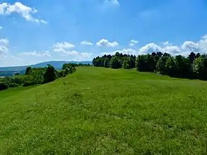 |
LSG GS 00056 | Östlicher Langenberg | 45,00 | 323587 | Position | 1984 |
_-_Adlerklippen_(14).jpg.webp) |
LSG GS 00059 | Harz (Landkreis Goslar) | 38975,00 | 321402 | Position | 2001 |
.jpg.webp) |
LSG GS 00061 | Bodensteiner Klippen und Klein Rhüdener Holz | 3140,00 | 390021 | Position | 2008 |
Anmerkungen
- Koordinaten wurden dem European Nature Information System (EUNIS) der Europäischen Umweltagentur entnommen: Nationally designated areas (CDDA), Datei CDDA_v12_csv.zip, Stand Oktober 2014. Die Tabellenspalte WDPA-ID gibt die genauen Grenzen an.
- Das Land Niedersachsen nennt das LSG „Nettetal“, der Landkreis Goslar „Nettetal (Landkreis Goslar)“ und das Bundesamt für Naturschutz „Oberes Nettetal“.
Siehe auch
Weblinks
Commons: Landschaftsschutzgebiete im Landkreis Goslar – Sammlung von Bildern, Videos und Audiodateien
Ammerland | Aurich | Braunschweig | Celle | Cloppenburg | Cuxhaven | Delmenhorst | Diepholz | Emden | Emsland | Friesland | Gifhorn | Goslar | Göttingen | Grafschaft Bentheim | Hameln-Pyrmont | Region Hannover | Harburg | Heidekreis | Helmstedt | Hildesheim | Holzminden | Leer | Lüchow-Dannenberg | Lüneburg | Nienburg/Weser | Northeim | Oldenburg (Land) | Oldenburg (Stadt) | Osnabrück (Land) | Osnabrück (Stadt) | Osterholz | Peine | Rotenburg (Wümme) | Salzgitter | Schaumburg | Stade | Uelzen | Vechta | Verden | Wesermarsch | Wilhelmshaven | Wittmund | Wolfenbüttel | Wolfsburg
This article is issued from Wikipedia. The text is licensed under Creative Commons - Attribution - Sharealike. The authors of the article are listed here. Additional terms may apply for the media files, click on images to show image meta data.