Liste der Landschaftsschutzgebiete im Landkreis Celle
Die Liste der Landschaftsschutzgebiete im Landkreis Celle enthält die Landschaftsschutzgebiete des Landkreises Celle in Niedersachsen.
| Bild | Nummer | Bezeichnung des Gebietes | Fläche in Hektar | WDPA-ID | Koordinaten[1] | Datum der Verordnung |
|---|---|---|---|---|---|---|
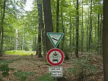
_IMG_7306.jpg.webp) |
LSG CE 00002 | Oertzetal von Müden bis zur Mündung in die Aller | 195,00 | 323461 | Position | 1937 |
| LSG CE 00016 | Habighorster Wacholderpark | 140,80 | Position | 1938 | ||
| LSG CE 00020 | Lachtetal | 27,20 | 390139 | Position | 1959 | |
 |
LSG CE 00025 | Südheide im Landkreis Celle | 39570,00 | 324910 | Position | 1992 |
| LSG CE 00033 | Müsse | 11,00 | 323106 | Position | 1981 | |
 |
LSG CE-S 00001 | Entenfang Boye | 437,00 | 320656 | Position | 1937 |
| LSG CE-S 00002 | Vogelschutzgehölz Matthieshagen | 2,00 | 325435 | Position | 1937 | |
| LSG CE-S 00003 | Der Behrenshop bei Altenhagen | 2,00 | 320317 | Position | 1938 | |
| LSG CE-S 00004 | Das Weiße Moor bei Hustedt | 211,00 | 320286 | Position | 1938 | |
| LSG CE-S 00005 | Oberes Allertal | 23,60 | 323356 | Position | 1953 | |
| LSG CE-S 00007 | Südheide im Gebiet der Stadt Celle | 1337,00 | 324909 | Position | 2016 | |
| LSG CE-S 00008 | Garßener Loh | 17,00 | 320956 | Position | 1997 |
Anmerkungen
- Koordinaten wurden dem European Nature Information System (EUNIS) der Europäischen Umweltagentur entnommen: Nationally designated areas (CDDA), Datei CDDA_v12_csv.zip, Stand Oktober 2014. Die Tabellenspalte WDPA-ID gibt die genauen Grenzen an.
Siehe auch
Weblinks
Commons: Landschaftsschutzgebiete im Landkreis Celle – Sammlung von Bildern, Videos und Audiodateien
Ammerland | Aurich | Braunschweig | Celle | Cloppenburg | Cuxhaven | Delmenhorst | Diepholz | Emden | Emsland | Friesland | Gifhorn | Goslar | Göttingen | Grafschaft Bentheim | Hameln-Pyrmont | Region Hannover | Harburg | Heidekreis | Helmstedt | Hildesheim | Holzminden | Leer | Lüchow-Dannenberg | Lüneburg | Nienburg/Weser | Northeim | Oldenburg (Land) | Oldenburg (Stadt) | Osnabrück (Land) | Osnabrück (Stadt) | Osterholz | Peine | Rotenburg (Wümme) | Salzgitter | Schaumburg | Stade | Uelzen | Vechta | Verden | Wesermarsch | Wilhelmshaven | Wittmund | Wolfenbüttel | Wolfsburg
This article is issued from Wikipedia. The text is licensed under Creative Commons - Attribution - Sharealike. The authors of the article are listed here. Additional terms may apply for the media files, click on images to show image meta data.