Liste der Landschaftsschutzgebiete in Wolfsburg
Die Liste der Landschaftsschutzgebiete in Wolfsburg enthält die Landschaftsschutzgebiete der kreisfreien Stadt Wolfsburg in Niedersachsen.
| Bild | Nummer | Bezeichnung des Gebietes | Fläche in Hektar | WDPA-ID | Koordinaten[1] | Datum der Verordnung |
|---|---|---|---|---|---|---|
| LSG WOB 00001 | Rothehofer Forst, Klieversberg und Detmerode | 878,60 | 323986 | Position | 1971 | |
 |
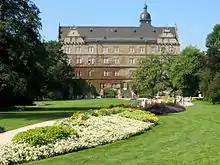
LSG WOB 00004 | Schlosspark Alt-Wolfsburg | 15,60 | 324203 | Position | 1971 |
| LSG WOB 00005 | Wolfsburger Moor, Butterberg und Lerchenberg | 132,80 | 325932 | Position | 1971 | |
| LSG WOB 00006 | Tiefes Moor | 40,00 | 325171 | Position | 1977 | |
| LSG WOB 00007 | Hackebusch-Kalkberge | 16,20 | 321297 | Position | 1938 | |
| LSG WOB 00008 | Hattorfer Holz | 443,40 | 321428 | Position | 1942 | |
| LSG WOB 00009 | Hohnstedter Holz und Wilshop | 480,00 | 321723 | Position | 1950 | |
 |
LSG WOB 00010 | Allertal – Barnbruch | 150,00 | 319488 | Position | 1939 |
 |
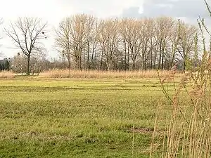
LSG WOB 00011 | Drömling | 32,80 | 320434 | Position | 1966 |
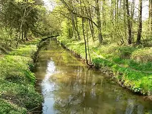
| LSG WOB 00012 | Mittlere Schunter | 265,00 | 322993 | Position | 1977 |
Anmerkungen
- Koordinaten wurden dem European Nature Information System (EUNIS) der Europäischen Umweltagentur entnommen: Nationally designated areas (CDDA), Datei CDDA_v12_csv.zip, Stand Oktober 2014.
Siehe auch
Weblinks
Commons: Landschaftsschutzgebiete in Wolfsburg – Sammlung von Bildern, Videos und Audiodateien
This article is issued from Wikipedia. The text is licensed under Creative Commons - Attribution - Sharealike. The authors of the article are listed here. Additional terms may apply for the media files, click on images to show image meta data.