Liste der Landschaftsschutzgebiete in Oldenburg (Oldb)
Die Liste der Landschaftsschutzgebiete in Oldenburg (Oldenburg) enthält die Landschaftsschutzgebiete der kreisfreien Stadt Oldenburg (Oldenburg) in Niedersachsen.
| Bild | Nummer | Bezeichnung des Gebietes | Fläche in Hektar | WDPA-ID | Koordinaten[1] | Datum der Verordnung |
|---|---|---|---|---|---|---|
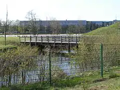
 im Februar 2016 |
LSG OL-S 00008 | Vogelschutzgebiet zwischen Küsten- und Osternburger Kanal | 0,90 | 325432 | Position | 1938 |
| LSG OL-S 00009 | Die Eichen am 19. Dragoner-Denkmal an der Cloppenburger Straße | 0,00 | 390033 | Position | 1938 | |
| LSG OL-S 00010 | Baumbestand Voßstraße und die Bäume an der Drielaker Schule | 0,10 | 319827 | Position | 1938 | |
| LSG OL-S 00011 | Rest des alten Krusenbusches | 4,00 | 323819 | Position | 1938 | |
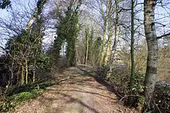
| LSG OL-S 00013 | Gerdshorst | 26,00 | 321059 | Position | 1994 | |
| LSG OL-S 00016 | Dorf Bümmerstede | 13,30 | 320403 | Position | 1938 | |
 Heiligengeistwall im Februar 2016 |
LSG OL-S 00017 | Heiligengeistwall | 1,50 | 390093 | Position | 1948 |
| LSG OL-S 00018 | Staulinie | 0,70 | 324781 | Position | 1947 | |
| LSG OL-S 00019 | Poststraße | 0,40 | 323703 | Position | 1947 | |
 Theaterwall im Februar 2016 |
LSG OL-S 00021 | Theaterwall | 4,70 | 325154 | Position | 1947 |
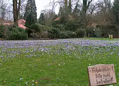
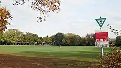
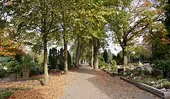
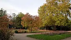 Cäcilienplatz im Herbst |
LSG OL-S 00022 | Cäcilienplatz | 0,70 | 320241 | Position | 1947 |
 Der Herbartplatz im Herbst |
LSG OL-S 00023 | Herbartplatz | 1,00 | 321554 | Position | 1947 |
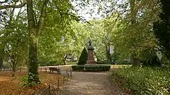
 im Februar |
LSG OL-S 00024 | Schlossgarten (Oldenburg) | 14,20 | 324198 | Position | 1951 |
 |
LSG OL-S 00025 | Elisabethstraße | 1,20 | 320590 | Position | 1947 |
 Pferdetränke im Eversten Holz |
LSG OL-S 00026 | Eversten Holz | 22,90 | 320724 | Position | 1995 |
 Dobbenwiese im Herbst |
LSG OL-S 00027 | Dobbenanlagen | 7,90 | 320377 | Position | 1947 |
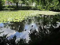
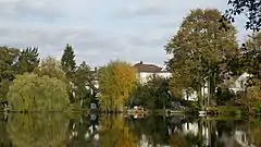 Herbststimmung am Wittschiebenteich |
LSG OL-S 00028 | Wittschiebenteich | 2,50 | 325923 | Position | 1947 |
| LSG OL-S 00029 | Schleusenstraße | 2,70 | 324173 | Position | 1947 | |
| LSG OL-S 00030 | Wunderburgpark | 2,60 | 325951 | Position | 1947 | |
| LSG OL-S 00031 | Infanterieweg -Anlagen- | 1,00 | 321925 | Position | 1947 | |
| LSG OL-S 00032 | Johann-Justus-Weg -Anlagen- | 5,40 | 322006 | Position | 1947 | |
| LSG OL-S 00033 | Volkspark an der Alexanderstraße (Kleiner Bürgerbusch) | 7,20 | 325443 | Position | 1947 | |
| LSG OL-S 00034 | Volkspark am Scheideweg (Großer Bürgerbusch) | 18,70 | 325442 | Position | 1947 | |
| LSG OL-S 00035 | Gelände am Nadorster Teich (Flötenteich) | 24,70 | 321038 | Position | 1947 | |
 Die verbliebene Zwillingseiche im Weißenmoor in Oldenburg. |
LSG OL-S 00036 | Weißenmoorstraße | 390421 | Position | 1947 | |
| LSG OL-S 00037 | Friedhof am Hochheider Weg | 1,30 | 320897 | Position | 1947 | |
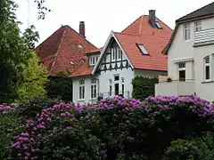
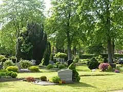 Friedhof Ohmstede |
LSG OL-S 00038 | Friedhof Ohmstede | 2,00 | 320905 | Position | 1948 |
 |
LSG OL-S 00039 | Gertrudenkirchhof | 3,30 | 321067 | Position | 1948 |
| LSG OL-S 00040 | Friedhof in Eversten | 3,00 | 320903 | Position | 1948 | |
| LSG OL-S 00041 | Alter Friedhof Osternburg | 0,90 | 319548 | Position | 1948 | |
| LSG OL-S 00042 | Neuer Friedhof Osternburg | 0,90 | 323188 | Position | 1948 | |
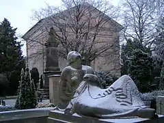
 im Herbst |
LSG OL-S 00043 | Katholischer Friedhof | 1,90 | 322070 | Position | 1948 |
| LSG OL-S 00044 | Jüdischer Friedhof | 0,30 | 322009 | Position | 1948 | |
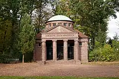 Ehrenhalle der oldenburgischen Artillerie |
LSG OL-S 00046 | Ehrenmal Ofener Straße | 0,00 | 320535 | Position | 1948 |
| LSG OL-S 00047 | Neuer Friedhof am Friedhofsweg | 9,50 | 323186 | Position | 1948 | |
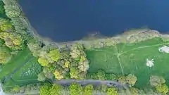 Rand des Großen Bornhorster See und Parkplatz |
LSG OL-S 00049 | Oldenburg - Rasteder Geestrand | 1226,20 | 323496 | Position | 1975 |
| LSG OL-S 00050 | Schloßgarten - Erweiterung | 2,00 | Position | 1954 | ||
| LSG OL-S 00053 | Blankenburger Holz und Klostermark | 390,00 | 319961 | Position | 1997 | |
| LSG OL-S 00055 | Baumbestand auf dem Grundstück des Ziegelhofes | 0,00 | 319821 | Position | 1965 | |
| LSG OL-S 00057 | Wüschemeer | 8,70 | 325965 | Position | 2001 | |
| LSG OL-S 00058 | Drielaker See | 21,50 | 320429 | Position | 1981 | |
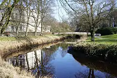
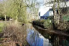
 |
LSG OL-S 00059 | Mühlenhunte (enthält Landschaftspark Mühlenhunte[2]) | 14,00 | 323083 | Position | 1981 |
 |
LSG OL-S 00060 | Haarenniederung | 67,00 | 321290 | Position | 1991 |
| LSG OL-S 00061 | Tegelbusch | 31,40 | 325108 | Position | 1958 | |
| LSG OL-S 00062 | Mittlere Hunte | 126,90 | 322987 | Position | 1976 | |
| LSG OL-S 00070 | Hausbäke-Niederung | 458,00 | 321442 | Position | 1996 |
Anmerkungen
- Koordinaten wurden dem European Nature Information System (EUNIS) der Europäischen Umweltagentur entnommen: Nationally designated areas (CDDA), Datei CDDA_v12_csv.zip, Stand Oktober 2014. Die Tabellenspalte WDPA-ID gibt die genauen Grenzen an.
- Landschaftspark Mühlenhunte, Webseite der Stadt Oldenburg, abgerufen am 15. August 2016.
Siehe auch
Weblinks
Commons: Landschaftsschutzgebiete in Oldenburg – Sammlung von Bildern, Videos und Audiodateien
- Niedersächsisches Ministerium für Umwelt, Energie, Bauen und Klimaschutz: Naturschutzrechtlich besonders geschützte Teile von Natur und Landschaft
- Stadt Oldenburg: Landschaftsschutzgebiete (LSG)
Ammerland | Aurich | Braunschweig | Celle | Cloppenburg | Cuxhaven | Delmenhorst | Diepholz | Emden | Emsland | Friesland | Gifhorn | Goslar | Göttingen | Grafschaft Bentheim | Hameln-Pyrmont | Region Hannover | Harburg | Heidekreis | Helmstedt | Hildesheim | Holzminden | Leer | Lüchow-Dannenberg | Lüneburg | Nienburg/Weser | Northeim | Oldenburg (Land) | Oldenburg (Stadt) | Osnabrück (Land) | Osnabrück (Stadt) | Osterholz | Peine | Rotenburg (Wümme) | Salzgitter | Schaumburg | Stade | Uelzen | Vechta | Verden | Wesermarsch | Wilhelmshaven | Wittmund | Wolfenbüttel | Wolfsburg
This article is issued from Wikipedia. The text is licensed under Creative Commons - Attribution - Sharealike. The authors of the article are listed here. Additional terms may apply for the media files, click on images to show image meta data.