Kanton Saint-Cyr-sur-Loire
Der Kanton Saint-Cyr-sur-Loire ist ein französischer Wahlkreis im Arrondissement Tours im Département Indre-et-Loire in der Region Centre-Val de Loire. Vertreter im Generalrat des Départements ist seit 2001, wiedergewählt 2008, Jean-Yves Couteau.
| Kanton Saint-Cyr-sur-Loire | |
|---|---|
| Region | Centre-Val de Loire |
| Département | Indre-et-Loire |
| Arrondissement | Tours |
| Hauptort | Saint-Cyr-sur-Loire |
| Einwohner | 36.774 (1. Jan. 2019) |
| Bevölkerungsdichte | 342 Einw./km² |
| Fläche | 107,54 km² |
| Gemeinden | 5 |
| INSEE-Code | 3712 |
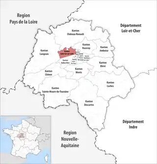 Lage des Kantons Saint-Cyr-sur-Loire im Département Indre-et-Loire | |
Gemeinden
Der Kanton besteht aus fünf Gemeinden mit insgesamt 36.774 Einwohnern (Stand: 1. Januar 2019) auf einer Gesamtfläche von 107,54 km²:
| Gemeinde | Einwohner 1. Januar 2019 |
Fläche km² |
Dichte Einw./km² |
Code INSEE |
Postleitzahl |
|---|---|---|---|---|---|
| Fondettes | 10.301 | 31,86 | 323 | 37109 | 37230 |
| La Membrolle-sur-Choisille | 3.300 | 6,87 | 480 | 37151 | 37390 |
| Luynes | 5.101 | 34,03 | 150 | 37139 | 37230 |
| Saint-Cyr-sur-Loire | 16.419 | 13,44 | 1.222 | 37214 | 37540 |
| Saint-Étienne-de-Chigny | 1.653 | 21,34 | 77 | 37217 | 37230 |
| Kanton Saint-Cyr-sur-Loire | 36.774 | 107,54 | 342 | 3712 | – |
Bis zur Neuordnung der französischen Kantone im Jahr 2015 gehörte dem Kanton einzig die Gemeinde Saint-Cyr-sur-Loire. Sein Zuschnitt entsprach einer Fläche von 13,50 km2. Er besaß vor 2015 einen anderen INSEE-Code als heute, nämlich 3729.
This article is issued from Wikipedia. The text is licensed under Creative Commons - Attribution - Sharealike. The authors of the article are listed here. Additional terms may apply for the media files, click on images to show image meta data.