Kanton Roquemaure
Der Kanton Roquemaure ist ein französischer Wahlkreis im Arrondissement Nîmes, im Département Gard und in der Region Okzitanien; sein Hauptort ist Roquemaure.
| Kanton Roquemaure | |
|---|---|
| Region | Okzitanien |
| Département | Gard |
| Arrondissement | Nîmes |
| Hauptort | Roquemaure |
| Einwohner | 27.193 (1. Jan. 2019) |
| Bevölkerungsdichte | 160 Einw./km² |
| Fläche | 169,73 km² |
| Gemeinden | 11 |
| INSEE-Code | 3017 |
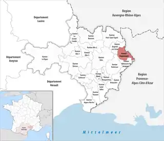 Lage des Kantons Roquemaure im Département Gard | |
Gemeinden
Der Kanton besteht aus elf Gemeinden mit insgesamt 27.193 Einwohnern (Stand: 1. Januar 2019) auf einer Gesamtfläche von 169,73 km²:
| Gemeinde | Einwohner 1. Januar 2019 |
Fläche km² |
Dichte Einw./km² |
Code INSEE |
Postleitzahl |
|---|---|---|---|---|---|
| Codolet | 618 | 5,46 | 113 | 30084 | 30200 |
| Laudun-l’Ardoise | 6.331 | 34,12 | 186 | 30141 | 30290 |
| Lirac | 927 | 9,80 | 95 | 30149 | 30126 |
| Montfaucon | 1.521 | 4,08 | 373 | 30178 | 30150 |
| Roquemaure | 5.545 | 26,27 | 211 | 30221 | 30150 |
| Saint-Geniès-de-Comolas | 1.997 | 8,28 | 241 | 30254 | 30150 |
| Saint-Laurent-des-Arbres | 3.000 | 16,37 | 183 | 30278 | 30126 |
| Saint-Paul-les-Fonts | 1.029 | 5,39 | 191 | 30355 | 30330 |
| Saint-Victor-la-Coste | 2.135 | 26,71 | 80 | 30302 | 30290 |
| Sauveterre | 2.061 | 13,21 | 156 | 30312 | 30150 |
| Tavel | 2.029 | 20,04 | 101 | 30326 | 30126 |
| Kanton Roquemaure | 27.193 | 169,73 | 160 | 3017 | – |
Bis zur landesweiten Neuordnung der französischen Kantone im März 2015 gehörten zum Kanton Roquemaure die neun Gemeinden Laudun-l’Ardoise, Lirac, Montfaucon, Roquemaure, Saint-Geniès-de-Comolas, Saint-Laurent-des-Arbres, Saint-Victor-la-Coste, Sauveterre und Tavel. Sein Zuschnitt entsprach einer Fläche von 158,71 km2. Er besaß vor 2015 den INSEE-Code 3023.
This article is issued from Wikipedia. The text is licensed under Creative Commons - Attribution - Sharealike. The authors of the article are listed here. Additional terms may apply for the media files, click on images to show image meta data.