Kanton Mont-Louis
Der Kanton Mont-Louis ist ein ehemaliger, bis 2015 bestehender französischer Wahlkreis im Arrondissement Prades, im Département Pyrénées-Orientales und in der Region Languedoc-Roussillon. Sein Hauptort war Mont-Louis. Vertreter im Generalrat des Départements war ab 2011 Pierre Bataille.
| Ehemaliger Kanton Mont-Louis | |
|---|---|
| Region | Languedoc-Roussillon |
| Département | Pyrénées-Orientales |
| Arrondissement | Prades |
| Hauptort | Mont-Louis |
| Auflösungsdatum | 29. März 2015 |
| Einwohner | 3.970 (1. Jan. 2012) |
| Bevölkerungsdichte | 13 Einw./km² |
| Fläche | 305.12 km² |
| Gemeinden | 15 |
| INSEE-Code | 6606 |
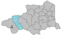
Lage im Département Pyrénées-Orientales
Der Kanton war 305,12 km² groß und hatte 28.886 Einwohner (Stand 1. Januar 2019).
Gemeinden
Der Kanton bestand aus 15 Gemeinden:
| Gemeinde | Einwohner Jahr | Fläche km² | Bevölkerungsdichte | Code INSEE | Postleitzahl |
|---|---|---|---|---|---|
| Les Angles | 528 (2013) | 43,2 | 12 Einw./km² | 66004 | 66210 |
| Bolquère | 790 (2013) | 17,61 | 45 Einw./km² | 66020 | 66210 |
| La Cabanasse | 684 (2013) | 3,26 | 210 Einw./km² | 66027 | 66210 |
| Caudiès-de-Conflent | 16 (2013) | 6,5 | 2 Einw./km² | 66047 | 66220 |
| Fontpédrouse | 131 (2013) | 64,35 | 2 Einw./km² | 66080 | 66360 |
| Fontrabiouse | 135 (2013) | 15,57 | 9 Einw./km² | 66081 | 66210 |
| Formiguères | 441 (2013) | 46,88 | 9 Einw./km² | 66082 | 66210 |
| La Llagonne | 234 (2013) | 23,09 | 10 Einw./km² | 66098 | 66210 |
| Matemale | 275 (2013) | 18,88 | 15 Einw./km² | 66105 | 66210 |
| Mont-Louis | 185 (2013) | 0,39 | 474 Einw./km² | 66117 | 66210 |
| Planès | 54 (2013) | 14,24 | 4 Einw./km² | 66142 | 66210 |
| Puyvalador | 73 (2013) | 19,46 | 4 Einw./km² | 66154 | 66210 |
| Réal | 63 (2013) | 10,45 | 6 Einw./km² | 66159 | 66210 |
| Saint-Pierre-dels-Forcats | 265 (2013) | 12,81 | 21 Einw./km² | 66188 | 66210 |
| Sauto | 93 (2013) | 8,43 | 11 Einw./km² | 66192 | 66210 |
Bevölkerungsentwicklung
| 1962 | 1968 | 1975 | 1982 | 1990 | 1999 | 2009 |
|---|---|---|---|---|---|---|
| 2.564 | 2.719 | 2.778 | 3.045 | 3.387 | 3.850 | 4.066 |
This article is issued from Wikipedia. The text is licensed under Creative Commons - Attribution - Sharealike. The authors of the article are listed here. Additional terms may apply for the media files, click on images to show image meta data.