Kanton Céret
Der Kanton Céret ist ein ehemaliger, bis 2015 bestehender französischer Kanton im Arrondissement Céret im Département Pyrénées-Orientales und in der Region Languedoc-Roussillon. Sein Hauptort war Céret. Vertreter im Generalrat des Départements war ab 2001, zuletzt wiedergewählt 2008, Robert Garrabe (PS).
| Ehemaliger Kanton Céret | |
|---|---|
| Region | Languedoc-Roussillon |
| Département | Pyrénées-Orientales |
| Arrondissement | Céret |
| Hauptort | Céret |
| Auflösungsdatum | 29. März 2015 |
| Einwohner | 22.167 (1. Jan. 2012) |
| Bevölkerungsdichte | 93 Einw./km² |
| Fläche | 237.31 km² |
| Gemeinden | 14 |
| INSEE-Code | 6603 |
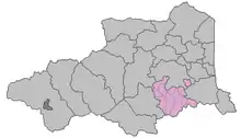
Lage im Département Pyrénées-Orientales
Der Kanton war 237,31 km² groß und hatte 31.672 Einwohner (Stand 1. Januar 2019).
Gemeinden
Der Kanton bestand aus 14 Gemeinden:
| Gemeinde | Einwohner Jahr | Fläche km² | Bevölkerungsdichte | Code INSEE | Postleitzahl |
|---|---|---|---|---|---|
| L’Albère | 82 (2013) | 17,1 | 5 Einw./km² | 66001 | 66480 |
| Banyuls-dels-Aspres | 1.257 (2013) | 10,53 | 119 Einw./km² | 66015 | 66300 |
| Le Boulou | 5.547 (2013) | 14,42 | 385 Einw./km² | 66024 | 66160 |
| Calmeilles | 65 (2013) | 13,22 | 5 Einw./km² | 66032 | 66400 |
| Céret | 7.663 (2013) | 37,86 | 202 Einw./km² | 66049 | 66400 |
| Les Cluses | 259 (2013) | 8,91 | 29 Einw./km² | 66063 | 66400 |
| Maureillas-las-Illas | 2.673 (2013) | 42,1 | 63 Einw./km² | 66106 | 66480 |
| Montauriol | 205 (2013) | 11,1 | 18 Einw./km² | 66112 | 66300 |
| Oms | 324 (2013) | 18,53 | 17 Einw./km² | 66126 | 66400 |
| Le Perthus | 583 (2013) | 4,27 | 137 Einw./km² | 66137 | 66480 |
| Reynès | 1.297 (2013) | 27,56 | 47 Einw./km² | 66160 | 66400 |
| Saint-Jean-Pla-de-Corts | 2.055 (2013) | 10,62 | 194 Einw./km² | 66178 | 66490 |
| Taillet | 128 (2013) | 10,02 | 13 Einw./km² | 66199 | 66400 |
| Vivès | 174 (2013) | 11,07 | 16 Einw./km² | 66233 | 66490 |
Bevölkerungsentwicklung
| 1962 | 1968 | 1975 | 1982 | 1990 | 1999 | 2006 | 2011 |
|---|---|---|---|---|---|---|---|
| 12.645 | 13.086 | 14.629 | 16.624 | 18.464 | 19.602 | 21.176 | 21.997 |
This article is issued from Wikipedia. The text is licensed under Creative Commons - Attribution - Sharealike. The authors of the article are listed here. Additional terms may apply for the media files, click on images to show image meta data.