Kanton La Plaine d’Illibéris
La Plaine d’Illibéris ist ein französischer Kanton in den Arrondissements Céret und Perpignan, im Département Pyrénées-Orientales und in der Region Okzitanien; sein Hauptort ist Elne.
| Kanton La Plaine d’Illibéris | |
|---|---|
| Region | Okzitanien |
| Département | Pyrénées-Orientales |
| Arrondissement | Céret (8 Gemeinden) Perpignan (1 Gemeinde) |
| Hauptort | Elne |
| Einwohner | 32.011 (1. Jan. 2019) |
| Bevölkerungsdichte | 402 Einw./km² |
| Fläche | 79,61 km² |
| Gemeinden | 9 |
| INSEE-Code | 6612 |
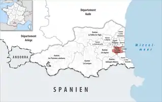 Lage des Kantons La Plaine d’Illibéris im Département Pyrénées-Orientales | |
Gemeinden
Der Kanton besteht aus neun Gemeinden mit insgesamt 32.011 Einwohnern (Stand: 1. Januar 2019) auf einer Gesamtfläche von 79,61 km²:
| Gemeinde | Einwohner 1. Januar 2019 |
Fläche km² |
Dichte Einw./km² |
Code INSEE |
Postleitzahl | Arrondissement |
|---|---|---|---|---|---|---|
| Alénya | 3.645 | 5,72 | 637 | 66002 | 66200 | Céret |
| Bages | 4.291 | 12,05 | 356 | 66011 | 66670 | Céret |
| Corneilla-del-Vercol | 2.327 | 5,37 | 433 | 66059 | 66200 | Céret |
| Elne | 9.248 | 22,03 | 420 | 66065 | 66200 | Céret |
| Latour-Bas-Elne | 3.158 | 3,36 | 940 | 66094 | 66200 | Céret |
| Montescot | 1.647 | 6,11 | 270 | 66114 | 66200 | Céret |
| Ortaffa | 1.591 | 8,50 | 187 | 66129 | 66560 | Céret |
| Théza | 2.127 | 4,87 | 437 | 66208 | 66200 | Céret |
| Villeneuve-de-la-Raho | 3.977 | 11,60 | 343 | 66227 | 66180 | Perpignan |
| Kanton La Plaine d’Illibéris | 32.011 | 79,61 | 402 | 6612 | – | – |
This article is issued from Wikipedia. The text is licensed under Creative Commons - Attribution - Sharealike. The authors of the article are listed here. Additional terms may apply for the media files, click on images to show image meta data.