Kanton Coudekerque-Branche
Der Kanton Coudekerque-Branche ist ein französischer Wahlkreis im Arrondissement Dunkerque, im Département Nord und in der Region Hauts-de-France.
| Kanton Coudekerque-Branche | |
|---|---|
| Region | Hauts-de-France |
| Département | Nord |
| Arrondissement | Dunkerque |
| Hauptort | Coudekerque-Branche |
| Einwohner | 49.277 (1. Jan. 2019) |
| Bevölkerungsdichte | 512 Einw./km² |
| Fläche | 96,33 km² |
| Gemeinden | 9 |
| INSEE-Code | 5912 |
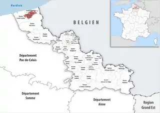 Lage des Kantons Coudekerque-Branche im Département Nord | |
Gemeinden
Der Kanton besteht aus neun Gemeinden mit insgesamt 49.277 Einwohnern (Stand: 1. Januar 2019) auf einer Gesamtfläche von 96,33 km²:
| Gemeinde | Einwohner 1. Januar 2019 |
Fläche km² |
Dichte Einw./km² |
Code INSEE |
Postleitzahl |
|---|---|---|---|---|---|
| Armbouts-Cappel | 2.200 | 10,19 | 216 | 59016 | 59380 |
| Bergues | 3.600 | 1,37 | 2.628 | 59067 | 59380 |
| Bierne | 1.801 | 11,17 | 161 | 59082 | 59380 |
| Cappelle-la-Grande | 7.920 | 5,48 | 1.445 | 59131 | 59180 |
| Coudekerque-Branche | 20.851 | 9,21 | 2.264 | 59155 | 59210 |
| Spycker | 1.806 | 9,47 | 191 | 59576 | 59380 |
| Steene | 1.371 | 10,37 | 132 | 59579 | 59380 |
| Téteghem-Coudekerque-Village | 8.285 | 30,99 | 267 | 59588 | 59229, 59380 |
| Uxem | 1.443 | 8,08 | 179 | 59605 | 59229 |
| Kanton Coudekerque-Branche | 49.277 | 96,33 | 512 | 5912 | – |
Veränderungen im Gemeindebestand seit 2015
2016: Fusion Coudekerque-Village und Téteghem → Téteghem-Coudekerque-Village
This article is issued from Wikipedia. The text is licensed under Creative Commons - Attribution - Sharealike. The authors of the article are listed here. Additional terms may apply for the media files, click on images to show image meta data.