Allen County (Indiana)
Allen County[3] ist ein County im Bundesstaat Indiana der Vereinigten Staaten. Der Verwaltungssitz (County Seat) ist Fort Wayne. Das County ist nach John Allen benannt worden, einem Offizier und Staatssenator aus Kentucky, der im Krieg von 1812 getötet wurde.
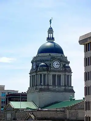
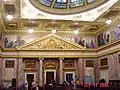
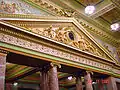
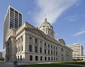 Allen County Courthouse in Fort Wayne, gelistet im NRHP Nr. 76000031[2] | |
| Verwaltung | |
|---|---|
| US-Bundesstaat: | Indiana |
| Verwaltungssitz: | Fort Wayne |
| Gründung: | 1824 |
| Demographie | |
| Einwohner: | 355.329 (2010) |
| Bevölkerungsdichte: | 208,65 Einwohner/km2 |
| Geographie | |
| Fläche gesamt: | 1710 km² |
| Wasserfläche: | 7 km² |
| Karte | |
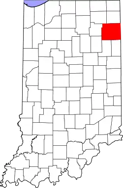 Karte von Allen County innerhalb von Indiana | |
| Website: www.co.allen.in.us | |
Geographie
Mit 1710 Quadratkilometern ist es das größte County in Indiana. Die Nachbar-Countys (im Norden startend, im Uhrzeigersinn) sind: Noble County, DeKalb County, Defiance County (Ohio), Paulding County (Ohio), Van Wert County (Ohio), Adams County, Wells County, Huntington County und Whitley County.
Geschichte
| ||||||||||||||||||||||||||||||||||||||||||||||||||||||||||||||||||||||||||||||||||||||||
Im Allen County liegt eine National Historic Landmark, das Allen County Courthouse in Fort Wayne.[7] Insgesamt sind 63 Bauwerke und Stätten des Countys im National Register of Historic Places eingetragen (Stand 31. August 2017).[8]
- Allen County Courthouse

Im Allen County haben sich seit 1852 Amische angesiedelt. In den schweizerdeutsch geprägten Communities findet man häufig die Namen Graber, Lengacher und Schwartz. Heute leben im County etwa 3.200 Personen in 22 Gemeinden.[9]
Städte im County
Cities
|
Towns
|
Weblinks
Einzelnachweise
- Auszug aus dem National Register of Historic Places. Abgerufen am 13. März 2011
- Auszug aus dem National Register of Historic Places. Abgerufen am 13. März 2011
- GNIS-ID: 450402. Abgerufen am 22. Februar 2011 (englisch).
- U.S. Census Bureau - Census of Population and Housing. Abgerufen am 15. März 2011
- Auszug aus Census.gov. Abgerufen am 15. Februar 2011
- Auszug aus census.gov (2000+2010) Abgerufen am 2. April 2012
- Listing of National Historic Landmarks by State: Indiana. National Park Service, abgerufen am 31. August 2017.
- Suchmaske Datenbank im National Register Information System. National Park Service, abgerufen am 31. August 2017.
- Amish America – The 12 Largest Amish Communities (2017) (englisch), abgerufen am 30. April 2018
Liste der Countys in Indiana
Adams |
Allen |
Bartholomew |
Benton |
Blackford |
Boone |
Brown |
Carroll |
Cass |
Clark |
Clay |
Clinton |
Crawford |
Daviess |
DeKalb |
Dearborn |
Decatur |
Delaware |
Dubois |
Elkhart |
Fayette |
Floyd |
Fountain |
Franklin |
Fulton |
Gibson |
Grant |
Greene |
Hamilton |
Hancock |
Harrison |
Hendricks |
Henry |
Howard |
Huntington |
Jackson |
Jasper |
Jay |
Jefferson |
Jennings |
Johnson |
Knox |
Kosciusko |
LaGrange |
Lake |
LaPorte |
Lawrence |
Madison |
Marion |
Marshall |
Martin |
Miami |
Monroe |
Montgomery |
Morgan |
Newton |
Noble |
Ohio |
Orange |
Owen |
Parke |
Perry |
Pike |
Porter |
Posey |
Pulaski |
Putnam |
Randolph |
Ripley |
Rush |
St. Joseph |
Scott |
Shelby |
Spencer |
Starke |
Steuben |
Sullivan |
Switzerland |
Tippecanoe |
Tipton |
Union |
Vanderburgh |
Vermillion |
Vigo |
Wabash |
Warren |
Warrick |
Washington |
Wayne |
Wells |
White |
Whitley