Saint-Sauveur-Camprieu
Saint-Sauveur-Camprieu ist eine Gemeinde mit 224 Einwohnern (Stand 1. Januar 2019) im französischen Département Gard.
| Saint-Sauveur-Camprieu | ||
|---|---|---|
.svg.png.webp)
|
| |
| Staat | Frankreich | |
| Region | Okzitanien | |
| Département (Nr.) | Gard (30) | |
| Arrondissement | Le Vigan | |
| Kanton | Le Vigan | |
| Gemeindeverband | Causses Aigoual Cévennes | |
| Koordinaten | 44° 7′ N, 3° 29′ O | |
| Höhe | 783–1402 m | |
| Fläche | 31,93 km² | |
| Einwohner | 224 (1. Januar 2019) | |
| Bevölkerungsdichte | 7 Einw./km² | |
| Postleitzahl | 30750 | |
| INSEE-Code | 30297 | |
Geographie
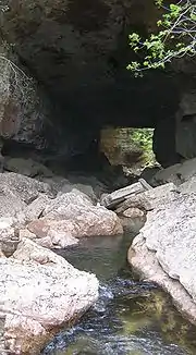
Saint-Sauveur-Camprieu liegt im Westen des Departements Gard. Die Ortschaft liegt in den Cevennen im Tal des Trèvezel, in der Nähe des Mont Aigoual. Die Durchgangshöhle Abîme de Bramabiau, aus der sich der Fluss Bramabiau ergießt, liegt auf dem Gebiet der Gemeinde.
Einwohner
| Jahr | 1962 | 1968 | 1975 | 1982 | 1990 | 1999 | 2008 | 2017 |
|---|---|---|---|---|---|---|---|---|
| Einwohner | 171 | 218 | 204 | 201 | 198 | 188 | 268 | 245 |
This article is issued from Wikipedia. The text is licensed under Creative Commons - Attribution - Sharealike. The authors of the article are listed here. Additional terms may apply for the media files, click on images to show image meta data.

