Saint-Andéol-de-Fourchades
Saint-Andéol-de-Fourchades ist eine französische Gemeinde mit 54 Einwohnern (Stand 1. Januar 2019) im Département Ardèche in der Region Auvergne-Rhône-Alpes.
| Saint-Andéol-de-Fourchades | ||
|---|---|---|
| ||
| Staat | Frankreich | |
| Region | Auvergne-Rhône-Alpes | |
| Département (Nr.) | Ardèche (07) | |
| Arrondissement | Tournon-sur-Rhône | |
| Kanton | Haut-Eyrieux | |
| Gemeindeverband | Val Eyrieux | |
| Koordinaten | 44° 51′ N, 4° 18′ O | |
| Höhe | 727–1486 m | |
| Fläche | 16,50 km² | |
| Einwohner | 54 (1. Januar 2019) | |
| Bevölkerungsdichte | 3 Einw./km² | |
| Postleitzahl | 07160 | |
| INSEE-Code | 07209 | |
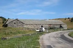 Gehöft auf dem Plateau | ||

Geografie
Das Bergdorf liegt auf einem Plateau im östlichen Zentralmassiv. Es ist Teil des Regionalen Naturparks Monts d’Ardèche.
Weblinks
Commons: Saint-Andéol-de-Fourchades – Sammlung von Bildern, Videos und Audiodateien
This article is issued from Wikipedia. The text is licensed under Creative Commons - Attribution - Sharealike. The authors of the article are listed here. Additional terms may apply for the media files, click on images to show image meta data.