Renfrew County
Renfrew County ist ein County im Südosten der kanadischen Provinz Ontario. Der County Seat ist Pembroke. Die Einwohnerzahl beträgt 102.394 (Stand: 2016), die Fläche 7448,57 km², was einer Bevölkerungsdichte von 13,7 Einwohnern je km² entspricht. Das County liegt am Ottawa River und zählt über 900 Seen.
| Renfrew County | |
|---|---|
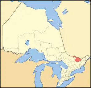 Lage der Region in Ontario | |
| Basisdaten | |
| Staat | Kanada |
| Provinz | Ontario |
| Verwaltungssitz | Pembroke |
| Koordinaten: | 45° 49′ N, 77° 7′ W |
| Einwohner | 102.394 (Stand: 2016[1]) |
| Fläche | 7.448,57 km² |
| Bevölkerungsdichte | 13,7 Einw./km² |
| Zeitzone: | Eastern Standard Time (UTC−5) Eastern Daylight Time (UTC−4, Sommerzeit) |
| Webpräsenz | www.countyofrenfrew.on.ca |
Im Norden des Bezirks liegt der rund 300 km² große Stützpunkt CFB Petawawa.
| Nipissing District | Témiscamingue (Québec) | Pontiac (Québec) |
| Nipissing District | .svg.png.webp) |
Lanark County |
| Hastings County | Lennox and Addington County | Frontenac County |
Administrative Gliederung
Städte und Gemeinden
| Ort | Status[2] | Bevölkerung (2016)[3] |
|---|---|---|
| Admaston/Bromley | Township | 2.935 |
| Arnprior | Town | 8.795 |
| Bonnechere Valley | Township | 3.674 |
| Brudenell, Lyndoch and Raglan | Township | 1.503 |
| Deep River | Town | 4.109 |
| Greater Madawaska | Township | 2.518 |
| Head, Clara and Maria | Township | 248 |
| Horton | Township | 2.887 |
| Killaloe, Hagarty and Richards | Township | 2.420 |
| Laurentian Hills | Town | 2.961 |
| Laurentian Valley | Township | 9.387 |
| Madawaska Valley | Township | 4.123 |
| McNab/Braeside | Township | 7.178 |
| North Algona-Wilberforce | Township | 2.915 |
| Petawawa | Town | 17.187 |
| Renfrew | Town | 8.223 |
| Whitewater Region | Township | 7.009 |
Die Stadt Pembroke gehört zwar geographisch und statistisch zum Renfrew County, untersteht aber nicht dessen Verwaltung. Sie hat den Status einer separated municipality.
Gemeindefreie Gebiete
Im Bezirk finden sich keine gemeindefreien Gebiete.
Indianerreservationen
- Pikwàkanagàn
Einzelnachweise
- Statistics Canada: Census Profile, 2016 Census – Renfrew, County (Census division), Ontario and Ontario (Province), abgerufen am 26. Mai 2021
- List of municipalities. Ontario Ministry of Municipal Affairs and Housing, 11. Mai 2021, abgerufen am 17. September 2021 (englisch).
- Census Profile, 2016 Census - Provincial Data. 17. Juni 2019, abgerufen am 17. September 2021 (englisch).
Einstufige Gemeinden: Brant | Brantford | Chatham-Kent | Greater Sudbury | Haldimand | Hamilton | Kawartha Lakes | Norfolk | Ottawa | Prince Edward | Toronto
Regionalgemeinden: Durham | Halton | Muskoka | Niagara | Oxford | Peel | Waterloo | York
Countys: Bruce | Dufferin | Elgin | Essex | Frontenac | Grey | Haliburton | Hastings | Huron | Lambton | Lanark | Leeds and Grenville | Lennox and Addington | Middlesex | Northumberland | Perth | Peterborough | Prescott and Russell | Renfrew | Simcoe | Stormont, Dundas and Glengarry | Wellington
Distrikte: Algoma | Cochrane | Kenora | Manitoulin | Nipissing | Parry Sound | Rainy River | Sudbury | Thunder Bay | Timiskaming