Hastings County
Hastings County ist ein County im Südosten der kanadischen Provinz Ontario. Der County Seat ist Belleville, das allerdings unabhängig vom County ist. Die Einwohnerzahl beträgt 136.445 (Stand: 2016), die Fläche 6103,92 km², was einer Bevölkerungsdichte von 22,4 Einwohnern je km² entspricht. Das County liegt am Nordufer des Ontariosees, an der Bay of Quinte und wird vom Trent-Severn-Wasserweg durchquert. Von 1837 bis 1849 trug es den Namen Victoria County. Benannt ist es nach Francis Rawdon-Hastings.
| Hastings County | |
|---|---|
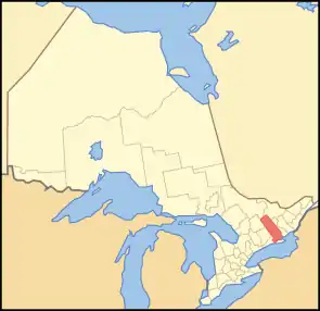 Lage der Region in Ontario | |
| Basisdaten | |
| Staat | Kanada |
| Provinz | Ontario |
| Verwaltungssitz | Belleville |
| Koordinaten: | 44° 42′ N, 77° 38′ W |
| Einwohner | 136.445 (Stand: 2016[1]) |
| Fläche | 6.103,92 km² |
| Bevölkerungsdichte | 22,4 Einw./km² |
| Zeitzone: | Eastern Standard Time (UTC−5) Eastern Daylight Time (UTC−4, Sommerzeit) |
| Webpräsenz | www.hastingscounty.com |
Im Norden des Bezirks liegen mehrere der Provincial Parks in Ontario.
| Haliburton County | Nipissing District | Renfrew County |
| Peterborough County | .svg.png.webp) |
Lennox and Addington County |
| Northumberland County | Prince Edward County |
Administrative Gliederung
Städte und Gemeinden
| Ort | Status[2] | Bevölkerung (2016)[3] |
|---|---|---|
| Bancroft | Town | 3.881 |
| Carlow/Mayo | Township | 864 |
| Centre Hastings | Municipality | 4.774 |
| Deseronto | Town | 1.774 |
| Faraday | Township | 1.401 |
| Hastings Highlands | Municipality | 4.078 |
| Limerick | Township | 346 |
| Madoc | Township | 2.078 |
| Marmora and Lake | Municipality | 3.953 |
| Stirling-Rawdon | Township | 4.882 |
| Tudor and Cashel | Township | 586 |
| Tweed | Municipality | 6.044 |
| Tyendinaga | Township | 4.297 |
| Wollaston | Township | 670 |
Die Städte Belleville und Quinte West gehören zwar geographisch und statistisch zum Hastings County, unterstehen aber nicht dessen Verwaltung. Sie haben den Status einer separated municipality.
Gemeindefreie Gebiete
Im Bezirk finden sich keine gemeindefreien Gebiete.
Indianerreservationen
- Tyendinaga Mohawk Territory
Einzelnachweise
- Statistics Canada: Census Profile, 2016 Census – Hastings, County (Census division), Ontario and Ontario (Province), abgerufen am 25. Mai 2021
- List of municipalities. Ontario Ministry of Municipal Affairs and Housing, 11. Mai 2021, abgerufen am 6. Oktober 2021 (englisch).
- Census Profile, 2016 Census - Provincial Data. 17. Juni 2019, abgerufen am 6. Oktober 2021 (englisch).
Einstufige Gemeinden: Brant | Brantford | Chatham-Kent | Greater Sudbury | Haldimand | Hamilton | Kawartha Lakes | Norfolk | Ottawa | Prince Edward | Toronto
Regionalgemeinden: Durham | Halton | Muskoka | Niagara | Oxford | Peel | Waterloo | York
Countys: Bruce | Dufferin | Elgin | Essex | Frontenac | Grey | Haliburton | Hastings | Huron | Lambton | Lanark | Leeds and Grenville | Lennox and Addington | Middlesex | Northumberland | Perth | Peterborough | Prescott and Russell | Renfrew | Simcoe | Stormont, Dundas and Glengarry | Wellington
Distrikte: Algoma | Cochrane | Kenora | Manitoulin | Nipissing | Parry Sound | Rainy River | Sudbury | Thunder Bay | Timiskaming