Podhorie (Banská Štiavnica)
Podhorie ist eine Gemeinde in der Mittelslowakei mit 326 Einwohnern (Stand 31. Dezember 2020).

Blick auf den Ort
| Podhorie | |||
|---|---|---|---|
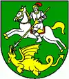
| Wappen | Karte | ||
 |
| ||
| Basisdaten | |||
| Staat: | Slowakei | ||
| Kraj: | Banskobystrický kraj | ||
| Okres: | Banská Štiavnica | ||
| Region: | Pohronie | ||
| Fläche: | 21,639 km² | ||
| Einwohner: | 326 (31. Dez. 2020) | ||
| Bevölkerungsdichte: | 15 Einwohner je km² | ||
| Höhe: | 428 m n.m. | ||
| Postleitzahl: | 969 82 | ||
| Telefonvorwahl: | 0 45 | ||
| Geographische Lage: | 48° 30′ N, 18° 55′ O | ||
| Kfz-Kennzeichen: | BS | ||
| Kód obce: | 517143 | ||
| Struktur | |||
| Gemeindeart: | Gemeinde | ||
| Gliederung Gemeindegebiet: | 2 Gemeindeteile | ||
| Verwaltung (Stand: November 2018) | |||
| Bürgermeister: | Dana Lóžiová | ||
| Adresse: | Obecný úrad Podhorie 84 96982 Podhorie | ||
| Webpräsenz: | www.podhorie.sk | ||
| Statistikinformation auf statistics.sk | |||
Sie liegt inmitten der Schemnitzer Berge (Štiavnické vrchy) und entstand 1964 durch den Zusammenschluss der Ortschaften Teplá (ungarisch Teplafő) und Žakýl (deutsch Seken, ungarisch Saskőszékely).
Bis 1918 gehörten die Ortsteile zum Königreich Ungarn und lagen im Komitat Hont.
Die Einwohner waren und sind vorwiegend in der Landwirtschaft beschäftigt.
Weblinks
Commons: Podhorie (Banská Štiavnica) – Sammlung von Bildern, Videos und Audiodateien
This article is issued from Wikipedia. The text is licensed under Creative Commons - Attribution - Sharealike. The authors of the article are listed here. Additional terms may apply for the media files, click on images to show image meta data.
