Misato (Saitama)
Misato (jap. 三郷市, -shi) ist eine Stadt in der Präfektur Saitama auf Honshū, der Hauptinsel von Japan.
| Misato-shi 三郷市 | |||
|---|---|---|---|
 Misato | |||
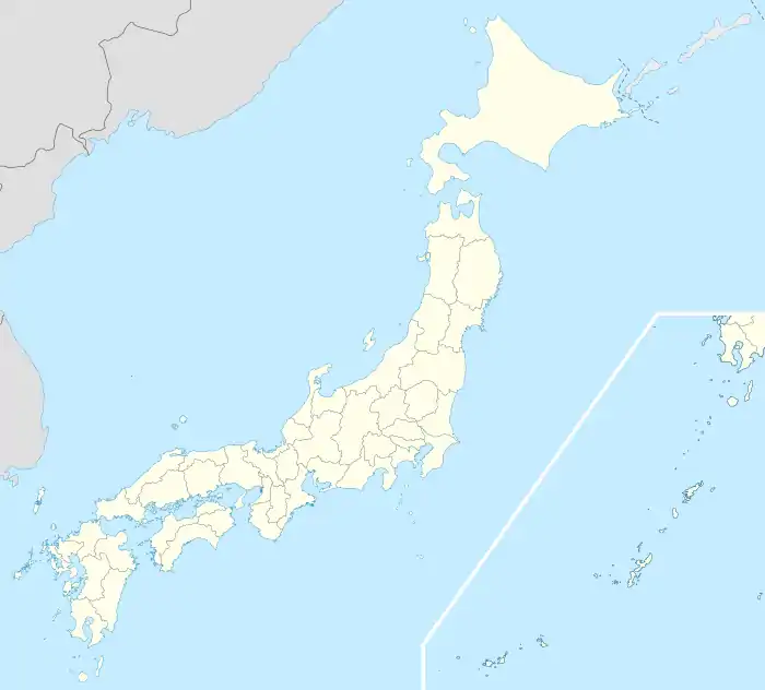
| Geographische Lage in Japan | |||
| |||
| Region: | Kantō | ||
| Präfektur: | Saitama | ||
| Koordinaten: | 35° 50′ N, 139° 52′ O | ||
| Basisdaten | |||
| Fläche: | 30,41 km² | ||
| Einwohner: | 141.913 (1. März 2021) | ||
| Bevölkerungsdichte: | 4667 Einwohner je km² | ||
| Gemeindeschlüssel: | 11237-2 | ||
| Symbole | |||
| Flagge/Wappen: |  | ||
| Baum: | Shii-Castanopsis | ||
| Blume: | Rhododendron indicum | ||
| Rathaus | |||
| Adresse: | Misato City Hall 648-1, Hanawada Misato-shi Saitama-ken 341-8501 | ||
| Webadresse: | http://www.city.misato.lg.jp/ | ||
| Lage der Stadt Misato in der Präfektur Saitama | |||
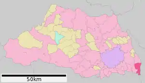 Lage Misatos in der Präfektur | |||
Geschichte
Misato bekam am 3. Mai 1972 das Stadtrecht.
Geographie
Misato liegt westlich von Nagareyama, östlich von Yashio und nördlich von Tokio.
Verkehr
- Straße:
- Jōban-Autobahn nach Watari
- Nationalstraße 298
- Zug:
- JR Musashino-Linie, nach Funabashi, Saitama und Fuchū
- Tsukuba-Express (TX) nach Akihabara oder Tsukuba
Angrenzende Städte und Gemeinden
- Präfektur Saitama
- Präfektur Chiba
- Präfektur Tokio
- Tokio: Stadtbezirk Katsushika
Weblinks
Kreisfreie Städte (shi): Ageo | Asaka | Chichibu | Fujimi | Fujimino | Fukaya | Gyōda | Hannō | Hanyū | Hasuda | Hidaka | Higashimatsuyama | Honjō | Iruma | Kasukabe | Kawagoe | Kawaguchi | Kazo | Kitamoto | Koshigaya | Kōnosu | Kuki | Kumagaya | Misato | Niiza | Okegawa | Saitama (Verwaltungssitz) | Sakado | Satte | Sayama | Shiki | Shiraoka | Sōka | Toda | Tokorozawa | Tsurugashima | Wakō | Warabi | Yashio | Yoshikawa
Chichibu-gun: Higashichichibu | Minano | Nagatoro | Ogano | Yokoze | Hiki-gun: Hatoyama | Kawajima | Namegawa | Ogawa | Ranzan | Tokigawa | Yoshimi | Iruma-gun: Miyoshi | Moroyama | Ogose | Kitaadachi-gun: Ina | Kitakatsushika-gun: Matsubushi | Sugito | Kodama-gun: Kamikawa | Kamisato | Misato | Minamisaitama-gun: Miyashiro | Ōsato-gun: Yorii