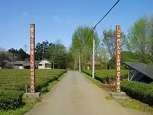
Moroyama (Saitama)
Moroyama (jap. 毛呂山町, -machi) ist eine Stadt im Zentrum der Präfektur Saitama.
| Moroyama-machi 毛呂山町 | |||
|---|---|---|---|
 Moroyama | |||
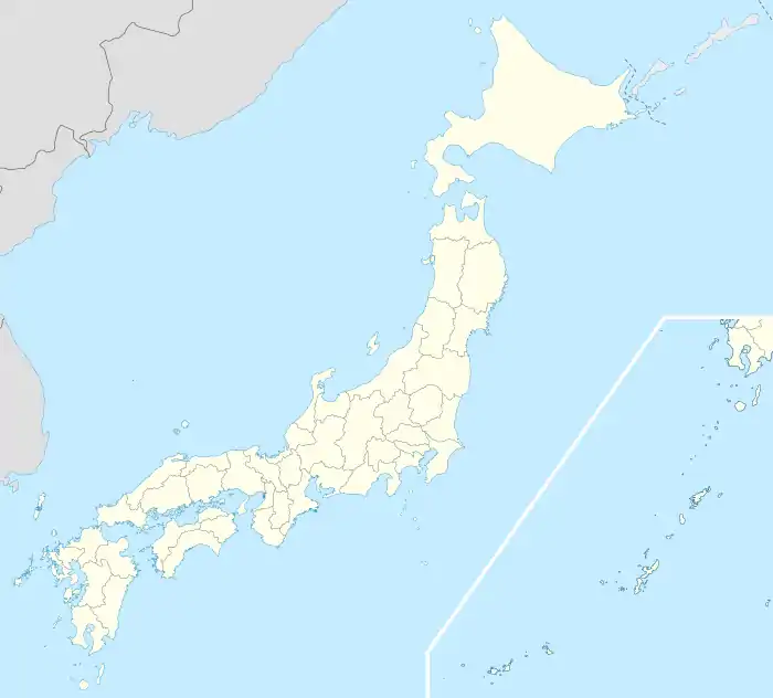
| Geographische Lage in Japan | |||
| |||
| Region: | Kantō | ||
| Präfektur: | Saitama | ||
| Koordinaten: | 35° 56′ N, 139° 19′ O | ||
| Basisdaten | |||
| Fläche: | 34,03 km² | ||
| Einwohner: | 35.370 (1. März 2021) | ||
| Bevölkerungsdichte: | 1039 Einwohner je km² | ||
| Gemeindeschlüssel: | 11326-3 | ||
| Symbole | |||
| Flagge/Wappen: |  | ||
| Baum: | Yuzu | ||
| Blume: | Garten-Chrysantheme | ||
| Vogel: | Zosterops japonicus | ||
| Rathaus | |||
| Adresse: | Moroyama Town Hall 1291 Ōaza Iwai Moroyama-machi, Iruma-gun Saitama-ken 350-0441 | ||
| Webadresse: | http://www.town.moroyama.saitama.jp | ||
| Lage der Stadt Moroyama in der Präfektur Saitama | |||
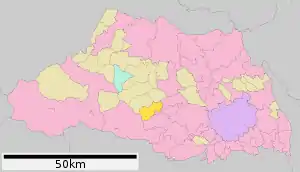 Lage Moroyamas in der Präfektur | |||
Verkehr
- Zug:
- JR Hachikō-Linie, nach Hachioji oder Takasaki
- Tōbu Ogose-Linie
Persönlichkeiten
- Daiya Seto (* 1994), Schwimmer
Weblinks
Kreisfreie Städte (shi): Ageo | Asaka | Chichibu | Fujimi | Fujimino | Fukaya | Gyōda | Hannō | Hanyū | Hasuda | Hidaka | Higashimatsuyama | Honjō | Iruma | Kasukabe | Kawagoe | Kawaguchi | Kazo | Kitamoto | Koshigaya | Kōnosu | Kuki | Kumagaya | Misato | Niiza | Okegawa | Saitama (Verwaltungssitz) | Sakado | Satte | Sayama | Shiki | Shiraoka | Sōka | Toda | Tokorozawa | Tsurugashima | Wakō | Warabi | Yashio | Yoshikawa
Chichibu-gun: Higashichichibu | Minano | Nagatoro | Ogano | Yokoze | Hiki-gun: Hatoyama | Kawajima | Namegawa | Ogawa | Ranzan | Tokigawa | Yoshimi | Iruma-gun: Miyoshi | Moroyama | Ogose | Kitaadachi-gun: Ina | Kitakatsushika-gun: Matsubushi | Sugito | Kodama-gun: Kamikawa | Kamisato | Misato | Minamisaitama-gun: Miyashiro | Ōsato-gun: Yorii