Misato-machi (Saitama)
Misato (jap. 美里町, -machi) ist eine Stadt auf der japanischen Hauptinsel Honshū im Landkreis Kodama in der Präfektur Saitama.
| Misato-machi 美里町 | |||
|---|---|---|---|
| |||
| Geographische Lage in Japan | |||
| Region: | Kantō | ||
| Präfektur: | Saitama | ||
| Koordinaten: | 36° 11′ N, 139° 11′ O | ||
| Basisdaten | |||
| Fläche: | 33,48 km² | ||
| Einwohner: | 10.783 (1. März 2021) | ||
| Bevölkerungsdichte: | 322 Einwohner je km² | ||
| Gemeindeschlüssel: | 11381-6 | ||
| Symbole | |||
| Flagge/Wappen: |  | ||
| Baum: | Japanische Rotkiefer | ||
| Blume: | Garten-Chrysantheme | ||
| Rathaus | |||
| Adresse: | Misato Town Hall 323-1, Ōaza Kibe Misato-machi, Kodama-gun Saitama-ken 367-0112 | ||
| Webadresse: | http://www.town.saitama-misato.lg.jp | ||
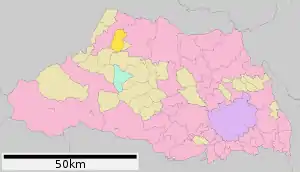
| Lage der Stadt Misato in der Präfektur Saitama | |||
 Lage Misatos in der Präfektur | |||
Verkehr
- Straße:
- Nationalstraße 254
- Zug:
- JR Hachikō-Linie: Bahnhof Matsuhisa nach Hachiōji oder Takasaki
Weblinks
Commons: Misato – Sammlung von Bildern, Videos und Audiodateien
This article is issued from Wikipedia. The text is licensed under Creative Commons - Attribution - Sharealike. The authors of the article are listed here. Additional terms may apply for the media files, click on images to show image meta data.
