Manitoba Census Division No. 23
Die Census Division No. 23 in der kanadischen Provinz Manitoba gehört zur North Region. Sie hat eine Fläche von 242.363,8 km² und 8971 Einwohner (Stand: 2016). 2011 betrug die Einwohnerzahl 8590.[2]
| Division No. 23 | |
|---|---|
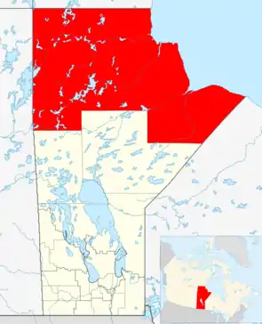 Lage der Region in Manitoba | |
| Basisdaten | |
| Staat | Kanada |
| Provinz | Manitoba |
| Koordinaten: | 58° 5′ N, 97° 52′ W |
| Einwohner | 8.971 (Stand: 2016[1]) |
| Fläche | 242.363,8 km² |
| Bevölkerungsdichte | 0 Einw./km² |
| Zeitzone: | Central Standard Time (UTC−6) Central Daylight Time (UTC−5, Sommerzeit) |
Gemeinden
Towns
- Churchill
- Gilliam
- Leaf Rapids
- Lynn Lake
Gemeindefreie Gebiete
- Amery
- Belcher
- Charlebois
- Herchmer
- Lawledge
- Weir River
Unorganized Area
- Manitoba Unorganized Area No. 23
Indianerreservate
Barren Lands First Nation
- Brochet 197
Fox Lake Cree Nation
- Fox Lake 2
Granville Lake
Lac Brochet
- Lac Brochet 197A
Mathias Clomb First Nation
- Highrock 199
Pukatawagan
- Pukatawagan 198
Shamattawa First Nation
- Shamattawa 1
South Indian Lake
Einzelnachweise
- Statistics Canada: Census Profile, 2016 Census – Division No. 23, Census division (Census division), Manitoba and Alberta (Province), abgerufen am 15. Mai 2021
- Statistics Canada: Census 2011. Abgerufen am 29. Juli 2012 (englisch).
Weblinks
- Census Profile: Census Division No. 23, Manitoba; Statistics Canada
- Census Profile: Karte Census Division No. 23, Manitoba; Statistics Canada
Division No. 1 | Division No. 2 | Division No. 3 | Division No. 4 | Division No. 5 | Division No. 6 | Division No. 7 | Division No. 8 | Division No. 9 | Division No. 10 | Division No. 11 | Division No. 12 | Division No. 13 | Division No. 14 | Division No. 15 | Division No. 16 | Division No. 17 | Division No. 18 | Division No. 19 | Division No. 20 | Division No. 21 | Division No. 22 | Division No. 23