Manitoba Census Division No. 10
Die Census Division No. 10 in der kanadischen Provinz Manitoba gehört zur North Central Region. Sie hat eine Fläche von 1914,6 km² und 11.941 Einwohner (Stand: 2016). 2011 betrug die Einwohnerzahl 10.673.[2]
| Division No. 10 | |
|---|---|
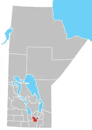 Lage der Region in Manitoba | |
| Basisdaten | |
| Staat | Kanada |
| Provinz | Manitoba |
| Koordinaten: | 49° 45′ N, 97° 28′ W |
| Einwohner | 11.941 (Stand: 2016[1]) |
| Fläche | 1.914,6 km² |
| Bevölkerungsdichte | 6,2 Einw./km² |
| Zeitzone: | Central Standard Time (UTC−6) Central Daylight Time (UTC−5, Sommerzeit) |
Gemeindefreie Gebiete
- Brunkild
- Dacotah
- Domain
- Elie
- La Salle
- Oak Bluff
- Osborne
- St. Eustache
- St. François Xavier
- Sanford
- Springstein
- Starbuck
- White Plains
Rural Municipalities
- RM Cartier
- RM Macdonald
- RM St. François Xavier
Einzelnachweise
- Statistics Canada: Census Profile, 2016 Census – Division No. 10, Census division (Census division), Manitoba and Alberta (Province), abgerufen am 15. Mai 2021
- Statistics Canada: Census 2011. Abgerufen am 29. Juli 2012 (englisch).
Weblinks
- Census Profile: Census Division No. 10, Manitoba; Statistics Canada
- Census Profile: Karte Census Division No. 10, Manitoba; Statistics Canada
Division No. 1 | Division No. 2 | Division No. 3 | Division No. 4 | Division No. 5 | Division No. 6 | Division No. 7 | Division No. 8 | Division No. 9 | Division No. 10 | Division No. 11 | Division No. 12 | Division No. 13 | Division No. 14 | Division No. 15 | Division No. 16 | Division No. 17 | Division No. 18 | Division No. 19 | Division No. 20 | Division No. 21 | Division No. 22 | Division No. 23
This article is issued from Wikipedia. The text is licensed under Creative Commons - Attribution - Sharealike. The authors of the article are listed here. Additional terms may apply for the media files, click on images to show image meta data.