Lesparrou
Lesparrou ist eine französische Gemeinde mit 233 Einwohnern (Stand 1. Januar 2019) im Département Ariège in der Region Okzitanien. Sie gehört zum Kanton Pays d’Olmes und zum Arrondissement Pamiers.
| Lesparrou | ||
|---|---|---|
.svg.png.webp)
|
| |
| Staat | Frankreich | |
| Region | Okzitanien | |
| Département (Nr.) | Ariège (09) | |
| Arrondissement | Pamiers | |
| Kanton | Pays d’Olmes | |
| Gemeindeverband | Communauté de communes du Pays d’Olmes | |
| Koordinaten | 42° 56′ N, 1° 54′ O | |
| Höhe | 440–761 m | |
| Fläche | 16,42 km² | |
| Einwohner | 233 (1. Januar 2019) | |
| Bevölkerungsdichte | 14 Einw./km² | |
| Postleitzahl | 09300 | |
| INSEE-Code | 09165 | |
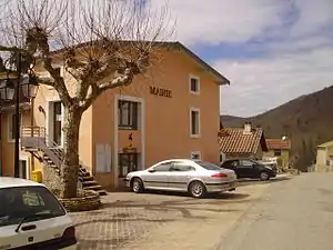 Die Mairie von Lesparrou | ||

Nachbargemeinden sind La Bastide-sur-l’Hers im Nordwesten, Le Peyrat im Norden, Sainte-Colombe-sur-l’Hers im Nordosten, Rivel im Osten, Bélesta im Südosten, L’Aiguillon im Süden, Saint-Jean-d’Aigues-Vives im Südwesten und Dreuilhe im Westen.
Bevölkerungsentwicklung
| Jahr | 1962 | 1968 | 1975 | 1982 | 1990 | 1999 | 2008 | 2016 |
|---|---|---|---|---|---|---|---|---|
| Einwohner | 458 | 387 | 366 | 291 | 290 | 265 | 243 | 232 |
Weblinks
Commons: Lesparrou – Sammlung von Bildern, Videos und Audiodateien
This article is issued from Wikipedia. The text is licensed under Creative Commons - Attribution - Sharealike. The authors of the article are listed here. Additional terms may apply for the media files, click on images to show image meta data.