Le Pla
Le Pla (auf okzitanisch Al Plan oder Lo Pla) ist eine französische Gemeinde mit 60 Einwohnern (Stand 1. Januar 2019) im Département Ariège in der Region Okzitanien. Sie gehört zum Kanton Haute-Ariège und zum Arrondissement Foix.
| Le Pla | ||
|---|---|---|
| ||
| Staat | Frankreich | |
| Region | Okzitanien | |
| Département (Nr.) | Ariège (09) | |
| Arrondissement | Foix | |
| Kanton | Haute-Ariège | |
| Gemeindeverband | Communauté de communes de la Haute Ariège | |
| Koordinaten | 42° 43′ N, 2° 5′ O | |
| Höhe | 983–2431 m | |
| Fläche | 13,21 km² | |
| Einwohner | 60 (1. Januar 2019) | |
| Bevölkerungsdichte | 5 Einw./km² | |
| Postleitzahl | 09460 | |
| INSEE-Code | 09230 | |
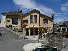
 Die Streusiedlung Le Pla | ||

Nachbargemeinden sind Rouze im Norden, Le Puch im Nordosten, Quérigut im Osten, Puyvalador im Südosten, Fontrabiouse im Süden und Artigues im Westen.
Bevölkerungsentwicklung
| Jahr | 1962 | 1968 | 1975 | 1982 | 1990 | 1999 | 2008 | 2015 |
|---|---|---|---|---|---|---|---|---|
| Einwohner | 88 | 86 | 64 | 71 | 75 | 79 | 67 | 56 |
| Quellen: Cassini und INSEE | ||||||||
Mairie Le Pla
This article is issued from Wikipedia. The text is licensed under Creative Commons - Attribution - Sharealike. The authors of the article are listed here. Additional terms may apply for the media files, click on images to show image meta data.