Kanton Chantilly
Der Kanton Chantilly ist ein französischer Wahlkreis im Arrondissement Senlis, im Département Oise und in der Region Hauts-de-France; sein Hauptort ist Chantilly.
| Kanton Chantilly | |
|---|---|
| Region | Hauts-de-France |
| Département | Oise |
| Arrondissement | Senlis |
| Hauptort | Chantilly |
| Einwohner | 42.060 (1. Jan. 2019) |
| Bevölkerungsdichte | 359 Einw./km² |
| Fläche | 117,32 km² |
| Gemeinden | 10 |
| INSEE-Code | 6003 |
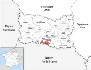 Lage des Kantons Chantilly im Département Oise | |
Gemeinden
Der Kanton besteht aus zehn Gemeinden mit insgesamt 42.060 Einwohnern (Stand: 1. Januar 2019) auf einer Gesamtfläche von 117,32 km²:
| Gemeinde | Einwohner 1. Januar 2019 |
Fläche km² |
Dichte Einw./km² |
Code INSEE |
Postleitzahl |
|---|---|---|---|---|---|
| Apremont | 644 | 13,74 | 47 | 60022 | 60300 |
| Boran-sur-Oise | 2.142 | 11,59 | 185 | 60086 | 60820 |
| Chantilly | 10.950 | 16,12 | 679 | 60141 | 60500 |
| Coye-la-Forêt | 3.976 | 7,06 | 563 | 60172 | 60580 |
| Crouy-en-Thelle | 1.116 | 5,86 | 190 | 60185 | 60530 |
| Gouvieux | 8.978 | 23,34 | 385 | 60282 | 60270 |
| Lamorlaye | 8.784 | 15,18 | 579 | 60346 | 60260 |
| Le Mesnil-en-Thelle | 2.207 | 6,03 | 366 | 60398 | 60530 |
| Morangles | 416 | 5,96 | 70 | 60429 | 60530 |
| Saint-Maximin | 2.847 | 12,44 | 229 | 60589 | 60740 |
| Kanton Chantilly | 42.060 | 117,32 | 359 | 6003 | – |
Bis zur Neuordnung bestand der Kanton Chantilly aus den sechs Gemeinden Apremont, Chantilly, Coye-la-Forêt, Gouvieux, Lamorlaye und Saint-Maximin. Sein Zuschnitt entsprach einer Fläche von 87,69 km2.
This article is issued from Wikipedia. The text is licensed under Creative Commons - Attribution - Sharealike. The authors of the article are listed here. Additional terms may apply for the media files, click on images to show image meta data.