Kanton Angers-5
Der Kanton Angers-5 ist ein französischer Wahlkreis im Arrondissement Angers, im Département Maine-et-Loire und in der Region Pays de la Loire. Sein Hauptort ist Angers.
| Kanton Angers-5 | |
|---|---|
| Region | Pays de la Loire |
| Département | Maine-et-Loire |
| Arrondissement | Angers |
| Hauptort | Angers |
| Einwohner | 40.365 (1. Jan. 2019) |
| Bevölkerungsdichte | 344 Einw./km² |
| Fläche | 117,51 km² |
| Gemeinden | 6 1⁄7 |
| INSEE-Code | 4905 |
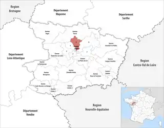
 Lage des Kantons Angers-5 im Département Maine-et-Loire | |
Gemeinden
Der Kanton besteht aus sieben Gemeinden und Gemeindeteilen mit insgesamt 40.365 Einwohnern (Stand: 1. Januar 2019) auf einer Gesamtfläche von 117,51 km²:
| Gemeinde | Einwohner 1. Januar 2019 |
Fläche km² |
Dichte Einw./km² |
Code INSEE |
Postleitzahl |
|---|---|---|---|---|---|
| Angers [A 1] | 26.259 | 12,11 | 2.168 | 49007 | 49000, 49100 |
| Briollay | 3.084 | 14,46 | 213 | 49048 | 49125 |
| Cantenay-Épinard | 2.317 | 16,57 | 140 | 49055 | 49460 |
| Écouflant | 4.394 | 17,59 | 250 | 49129 | 49000 |
| Écuillé | 667 | 12,54 | 53 | 49130 | 49460 |
| Feneu | 2.192 | 25,91 | 85 | 49135 | 49460 |
| Soulaire-et-Bourg | 1.492 | 18,33 | 81 | 49339 | 49460 |
| Kanton Angers-5 | 40.365 | 117,51 | 344 | 4905 | – |
This article is issued from Wikipedia. The text is licensed under Creative Commons - Attribution - Sharealike. The authors of the article are listed here. Additional terms may apply for the media files, click on images to show image meta data.