Yorke-Inseln
Die Yorke-Inseln sind eine australische Inselgruppe im Norden des Archipels der Torres-Strait-Inseln. Sie liegen etwa 85 km südöstlich von Papua-Neuguinea und 135 km nordöstlich der Nordspitze Australiens. Die Inselgruppe grenzt im Osten an die Murray-Inseln im Süden an die Bourke-Inseln.
| Yorke-Inseln | |
|---|---|
.png.webp) Landsat-Bild der Inselgruppe | |
| Gewässer | Pazifischer Ozean |
| Archipel | Torres-Strait-Inseln |
| Geographische Lage | 9° 45′ S, 143° 23′ O |
| Anzahl der Inseln | 6 |
| Hauptinsel | Yorke Island (Masig) |
| Gesamte Landfläche | 2,66 km² |
| Einwohner | 270 (2016) |
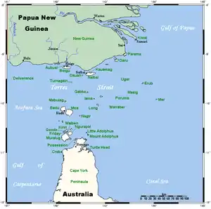 Lage der Torres-Strait-Inseln | |
Es handelt sich bei den Yorke-Inseln um kleine Koralleninseln. Lediglich die Hauptinsel Yorke ist bewohnt.[1]
Die Gruppe besteht aus sechs Inseln, von denen Yorke und Kodall auf einem gemeinsamen Riff aufliegen:
| Inselname | Bevölkerung (2016) | Fläche km² |
Geokoordinaten |
|---|---|---|---|
| Yorke Island (Masig) | 270 | 1,62 | 9° 45′ S, 143° 25′ O |
| Kodall Islet | - | 0,30 | 9° 44′ S, 143° 27′ O |
| Keats Island (Homogar) | - | 0,05 | 9° 42′ S, 143° 26′ O |
| Marsden Islet (Igab) | - | 0,21 | 9° 43′ S, 143° 22′ O |
| Rennell Island (Mawarr) | - | 0,46 | 9° 46′ S, 143° 16′ O |
| Smith Cay | - | 0,02 | 9° 46′ S, 143° 19′ O |
Verwaltungstechnisch gehören die Yorke-Inseln zu den Central Islands, einer Inselregion im Verwaltungsbezirk Torres Shire von Queensland.
Siehe auch
Einzelnachweise
- 2016 Census QuickStats: Yorke Island (L). Abgerufen am 6. Februar 2022 (englisch).
This article is issued from Wikipedia. The text is licensed under Creative Commons - Attribution - Sharealike. The authors of the article are listed here. Additional terms may apply for the media files, click on images to show image meta data.