Duncan-Inseln
Die Duncan-Inseln sind eine australische Inselgruppe zwischen Australien und Neuguinea. Sie liegen im Westen des Archipels der Torres-Strait-Inseln, etwa 14 km westlich von Moa Island.
| Duncan-Inseln | |
|---|---|
.png.webp) Landsat-Bild der Gruppe | |
| Gewässer | Pazifischer Ozean |
| Archipel | Torres-Strait-Inseln |
| Geographische Lage | 10° 14′ S, 142° 5′ O |
| Anzahl der Inseln | ca. 15 |
| Gesamte Landfläche | 0,8 km² |
| Einwohner | unbewohnt |
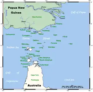 Lage der Torres-Strait-Inseln | |
Es handelt sich um einige sehr kleine flache Felsinseln; alle Inseln sind unbewohnt.
Zu der Gruppe zählen u. a. folgende Inselchen:
![]() Karte mit allen Koordinaten: OSM | WikiMap
Karte mit allen Koordinaten: OSM | WikiMap
| Inselname | Fläche (km²), ca. | Geokoordinaten |
|---|---|---|
| Ngurtai | 0,03 | 10° 13′ S, 142° 03′ O |
| Quoin Island | 0,06 | 10° 13′ S, 142° 04′ O |
| Meth Island | 0,04 | 10° 14′ S, 142° 04′ O |
| Wilson Island | 0,40 | 10° 14′ S, 142° 05′ O |
| Kanig Island | 0,26 | 10° 15′ S, 142° 05′ O |
Verwaltungstechnisch gehören die Duncan-Inseln zu den Western Islands, einer Inselregion im Verwaltungsbezirk Torres Shire von Queensland.
Siehe auch
This article is issued from Wikipedia. The text is licensed under Creative Commons - Attribution - Sharealike. The authors of the article are listed here. Additional terms may apply for the media files, click on images to show image meta data.