Vollore-Montagne
Vollore-Montagne ist eine französische Gemeinde mit 300 Einwohnern (Stand 1. Januar 2019) im Département Puy-de-Dôme in der Region Auvergne-Rhône-Alpes. Sie gehört zum Arrondissement Thiers und zum Kanton Thiers. Das Gemeindegebiet liegt im Regionalen Naturpark Livradois-Forez.
| Vollore-Montagne | ||
|---|---|---|
.svg.png.webp)
|
| |
| Staat | Frankreich | |
| Region | Auvergne-Rhône-Alpes | |
| Département (Nr.) | Puy-de-Dôme (63) | |
| Arrondissement | Thiers | |
| Kanton | Thiers | |
| Gemeindeverband | Thiers Dore et Montagne | |
| Koordinaten | 45° 47′ N, 3° 40′ O | |
| Höhe | 620–1267 m | |
| Fläche | 21,18 km² | |
| Einwohner | 300 (1. Januar 2019) | |
| Bevölkerungsdichte | 14 Einw./km² | |
| Postleitzahl | 63120 | |
| INSEE-Code | 63468 | |
Vor der Revolution hieß der Ort "La Chapelle-Trinquart" und gehörte zur Pfarrei Vollore, die 1791 in die Gemeinde Vollore-Ville und Vollore-Montagne aufgeteilt wurde.
Nachbargemeinden von Vollore-Montagne sind Augerolles, La Renaudie, Sainte-Agathe und Vollore-Ville im Kanton Courpière, Viscomat im Kanton Saint-Rémy-sur-Durolle sowie La Chamba, La Chambonie und Noirétable im Kanton Noirétable.
Bevölkerungsentwicklung
| Jahr | 1962 | 1968 | 1975 | 1982 | 1990 | 1999 | 2007 | |
| Einwohner | 595 | 623 | 520 | 450 | 397 | 371 | 347 | |
| Quellen: Cassini und INSEE | ||||||||
Weblinks
Commons: Vollore-Montagne – Sammlung von Bildern, Videos und Audiodateien

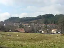
Blick auf Vollore-Montagne
This article is issued from Wikipedia. The text is licensed under Creative Commons - Attribution - Sharealike. The authors of the article are listed here. Additional terms may apply for the media files, click on images to show image meta data.
