Strabane (District)
Strabane (irisch An Srath Bán) war einer der 26 nordirischen Districts, die von 1973 bis 2015 bestanden. Der District lag in der traditionellen Grafschaft Tyrone. Bedeutende Orte waren der Verwaltungssitz Strabane sowie Plumbridge, Newtownstewart, Donemana, Sion Mills und Castlederg. Zum 1. April 2015 ging er im neuen District Derry and Strabane auf.
| Strabane District Ceantar an tSratha Báin | |
|---|---|
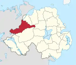 Lage in Nordirland | |
| Geografie | |
| Traditionelle Grafschaft | County Tyrone |
| Fläche | 862 km² |
| Verwaltungssitz | Strabane |
| ISO 3166-2 | GB-STB |
| Demografie | |
| Bevölkerung | 40.033 (2012)[1] |
| Dichte | 46 Ew./km² |
| Konfessionen | Protestanten 30,8 % Katholiken 60,1 %[2] |
Strabane Council
Die Wahl zum Strabane Council am 11. Mai 2011 hatte folgendes Ergebnis:[3]
| Partei | Ergebnis 2011 | Veränderung zu 2005 | |||
|---|---|---|---|---|---|
| Sitze | Stimmen | Sitze | Stimmen | ||
| Sinn Féin | 8 | 39,3 % | 0 | −2,4 % | |
| Democratic Unionist Party (DUP) | 4 | 23,2 % | 1 | 1,0 % | |
| Ulster Unionist Party (UUP) | 1 | 13,6 % | −1 | −0,5 % | |
| Social Democratic and Labour Party (SDLP) | 1 | 9,2 % | −1 | −6,7 % | |
| Unabhängige | 2 | 10,8 % | 1 | 5,2 % | |
| Sonstige | 0 | 3,8 % | 0 | 3,5 % | |
Siehe auch
Einzelnachweise
- Northern Ireland Population Estimates 2012 (XLS-Datei)
- Northern Ireland Census 2011: Religion (administrative geographies)
- Wahlergebnis bei BBC News (Abgerufen am 26. Juli 2011)
Antrim | Ards | Armagh | Ballymena | Ballymoney | Banbridge | Belfast | Carrickfergus | Castlereagh | Coleraine | Cookstown | Craigavon | Derry | Down | Dungannon and South Tyrone | Fermanagh | Larne | Limavady | Lisburn | Magherafelt | Moyle | Newry and Mourne | Newtownabbey | North Down | Omagh | Strabane