Fermanagh (District)
Fermanagh (irisch Fear Manach) war einer der 26 nordirischen Districts, die von 1973 bis 2015 bestanden. Der District umfasste die gesamte traditionelle Grafschaft Fermanagh sowie Teile der traditionellen Grafschaft Tyrone. Der Verwaltungssitz des flächenmäßig größten nordirischen Districts in dieser Zeit war Enniskillen. Weitere Orte waren Lisnaskea, Irvinestown, Belleek, Belcoo, Derrylin und Rosslea. Ein Fünftel der Fläche des Districts wurden von dem Gewässer Lough Erne eingenommen. Zum 1. April 2015 ging er im neuen District Fermanagh and Omagh auf.
| Fermanagh District Ceantar Fhear Manach | |
|---|---|
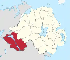 Lage in Nordirland | |
| Geografie | |
| Traditionelle Grafschaft | County Fermanagh County Tyrone |
| Fläche | 1876 km² |
| Verwaltungssitz | Enniskillen |
| ISO 3166-2 | GB-FER |
| Demografie | |
| Bevölkerung | 62.400 (2012)[1] |
| Dichte | 33 Ew./km² |
| Konfessionen | Protestanten 34,3 % Katholiken 54,9 %[2] |
Fermanagh Council
Die Wahl zum Fermanagh Council am 11. Mai 2011 hatte folgendes Ergebnis:[3]
| Partei | Ergebnis 2011 | Veränderung zu 2005 | |||
|---|---|---|---|---|---|
| Sitze | Stimmen | Sitze | Stimmen | ||
| Sinn Féin | 9 | 36,6 % | 0 | −0,8 % | |
| Ulster Unionist Party (UUP) | 6 | 24,0 % | 1 | 1,9 % | |
| Democratic Unionist Party (DUP) | 4 | 17,3 % | 0 | −3,4 % | |
| Social Democratic and Labour Party (SDLP) | 3 | 12,5 % | −2 | −5,4 % | |
| Traditional Unionist Voice | 0 | 1,0 % | 0 | 1,0 % | |
| Alliance Party | 0 | 0,4 % | 0 | 0,4 % | |
| Green Party | 0 | 0,2 % | 0 | −0,1 % | |
| Unabhängige | 1 | 7,3 % | 1 | 6,9 % | |
| Sonstige | 0 | 0,8 % | 0 | −0,5 % | |
Siehe auch
Einzelnachweise
- Northern Ireland Population Estimates 2012 (XLS-Datei)
- Northern Ireland Census 2011: Religion (administrative geographies)
- Wahlergebnis bei BBC News (Abgerufen am 26. Juli 2011)
Antrim | Ards | Armagh | Ballymena | Ballymoney | Banbridge | Belfast | Carrickfergus | Castlereagh | Coleraine | Cookstown | Craigavon | Derry | Down | Dungannon and South Tyrone | Fermanagh | Larne | Limavady | Lisburn | Magherafelt | Moyle | Newry and Mourne | Newtownabbey | North Down | Omagh | Strabane