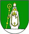
Stará Lehota
Stará Lehota (deutsch Altlehota – älter auch Althau, ungarisch Szentmiklósvölgye – bis 1907 Ólehota) ist eine Gemeinde in der Westslowakei.
| Stará Lehota | |||
|---|---|---|---|
| Wappen | Karte | ||
 |
| ||
| Basisdaten | |||
| Staat: | Slowakei | ||
| Kraj: | Trenčiansky kraj | ||
| Okres: | Nové Mesto nad Váhom | ||
| Region: | Dolné Považie | ||
| Fläche: | 16,167 km² | ||
| Einwohner: | 181 (31. Dez. 2020) | ||
| Bevölkerungsdichte: | 11 Einwohner je km² | ||
| Höhe: | 337 m n.m. | ||
| Postleitzahl: | 916 36 | ||
| Telefonvorwahl: | 0 33 | ||
| Geographische Lage: | 48° 39′ N, 17° 57′ O | ||
| Kfz-Kennzeichen: | NM | ||
| Kód obce: | 506516 | ||
| Struktur | |||
| Gemeindeart: | Gemeinde | ||
| Verwaltung (Stand: November 2018) | |||
| Bürgermeister: | Peter Michalka | ||
| Adresse: | Obecný úrad Stará Lehota 35 91635 Modrová | ||
| Webpräsenz: | staralehota.sk | ||
| Statistikinformation auf statistics.sk | |||
Der Ort wurde 1348 zum ersten Mal genannt und liegt zirka 20 Kilometer südöstlich der Stadt Nové Mesto nad Váhom im Gebirge Inowetz.
This article is issued from Wikipedia. The text is licensed under Creative Commons - Attribution - Sharealike. The authors of the article are listed here. Additional terms may apply for the media files, click on images to show image meta data.
