Horná Streda
Horná Streda (bis 1927 slowakisch „Streda“, bis 1948 „Horná Streda nad Váhom“; ungarisch Felsőszerdahely – bis 1907 Vágszerdahely) ist eine Gemeinde in der Westslowakei. Sie liegt im nördlichen Donauhügelland am Fluss Waag, 8 km von Piešťany und 13 km von Nové Mesto nad Váhom entfernt.
.jpg.webp)
Blick auf die Kirche
| Horná Streda | |||
|---|---|---|---|
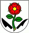
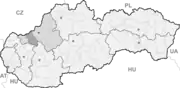
| Wappen | Karte | ||
 |
| ||
| Basisdaten | |||
| Staat: | Slowakei | ||
| Kraj: | Trenčiansky kraj | ||
| Okres: | Nové Mesto nad Váhom | ||
| Region: | Stredné Považie | ||
| Fläche: | 9,827 km² | ||
| Einwohner: | 1.394 (31. Dez. 2020) | ||
| Bevölkerungsdichte: | 142 Einwohner je km² | ||
| Höhe: | 169 m n.m. | ||
| Postleitzahl: | 916 24 | ||
| Telefonvorwahl: | 0 32 | ||
| Geographische Lage: | 48° 39′ N, 17° 51′ O | ||
| Kfz-Kennzeichen: | NM | ||
| Kód obce: | 506001 | ||
| Struktur | |||
| Gemeindeart: | Gemeinde | ||
| Verwaltung (Stand: November 2018) | |||
| Bürgermeister: | Ľubomír Krajňanský | ||
| Adresse: | Obecný úrad Horná Streda 407 91624 Horná Streda | ||
| Webpräsenz: | www.hornastreda.sk | ||
| Statistikinformation auf statistics.sk | |||
Der Ort wurde 1263 erstmals schriftlich erwähnt.
Er besitzt eine Haltestelle an der Bahnstrecke Bratislava–Žilina sowie eine Ausfahrt der Autobahn D1.
Weblinks
Commons: Horná Streda – Sammlung von Bildern, Videos und Audiodateien
This article is issued from Wikipedia. The text is licensed under Creative Commons - Attribution - Sharealike. The authors of the article are listed here. Additional terms may apply for the media files, click on images to show image meta data.