Selayarinseln
Die Selayarinseln, auch Selajarinseln (indonesisch Kepulauan Selayar), sind eine indonesische Inselgruppe. Sie bilden einen Regierungsbezirk (Kabupaten) der Provinz Sulawesi Selatan, südlich der Insel Sulawesi. Der Bezirk umfasst die Hauptinsel Selayar und mehrere Nebeninseln, darunter Pasi Tallu, Gusung Tallang, Bahuluang, Kalao, Bonerate, Kajuwadi, Jampea, Lalao (auch Lambego) und Kalaotoa. Hier leben 121.905 Einwohner (2010).
| Kabupaten Kepulauan Selayar Regierungsbezirk Selayarinseln | ||
|---|---|---|
 | ||
| Symbole | ||
| ||
| Basisdaten | ||
| Staat | Indonesien | |
| Provinz | Sulawesi Selatan | |
| Sitz | Benteng | |
| Fläche | 10.503,7 km² | |
| Einwohner | 121.905 (2010) | |
| Dichte | 12 Einwohner pro km² | |
| ISO 3166-2 | ID-SN | |
| Webauftritt | www.kepulauanselayarkab.go.id | |
| Politik | ||
| Bupati | Drs. H. Syahrir Wahab, MM | |
Geographie
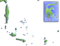
Der Bezirk Kepulauan Selayar hat eine Fläche von 10503,69 km². Die Hauptstadt ist Benteng. Zum Bezirk gehört der maritime Nationalpark Taka Bone Rate.
Verwaltungsgliederung
Der Bezirk Kepulauan Selayar setzt sich aus elf administrativen Distrikten (Kecamatan) zusammen (Stand 2010):[1]
| Name | Bevölkerung Zensus 2010 | Hauptstadt |
|---|---|---|
| Pasimarannu | 8.959 | Bonerate |
| Pasilambena | 6.786 | Kalaotoa |
| Pasimassunggu | 7.625 | Kembang Ragi |
| Taka Bonerate | 12.296 | Batang |
| Ostpasimassunggu (Pasimassunggu Timur) | 7.307 | Bontobulaeng |
| Bontosikuyu | 14.332 | Harapan |
| Bontoharu | 12.484 | Bontobangun |
| Benteng | 21.344 | Benteng |
| Bontomanai | 12.226 | Polebungin |
| Bontomatene | 12.571 | Batangmata |
| Buki | 6.125 | Buki |
Einzelnachweise
- Biro Pusat Statistik, Jakarta, 2011.

Regierungsbezirk:
Bantaeng |
Barru |
Bone |
Bulukumba |
Enrekang |
Gowa |
Jeneponto |
Luwu |
Maros |
Nordluwu (Luwu Utara) |
Nordtoraja (Toraja Utara) |
Ostluwu (Luwu Timur) |
Pangkajene und Inseln (Pangkajene dan Kepulauan) |
Pinrang |
Salajarinseln (Kepulauan Selayar) |
Sidenreng Rappang |
Sinjai |
Soppeng |
Takalar |
Tana Toraja |
Wajo
Stadt:
Makassar |
Palopo |
Pare-Pare
Cibodas (1977) | Komodo (1977) | Lore Lindu (1977) | Tanjung Puting (1977) | Gunung Leuser (1981) | Siberut (1981) | Kiam Siak Kecil - Bukit Batu (2009) | Wakatobi (2012) | Bromo Tengger Semeru-Arjuno (2015) | Taka Bone Rate – Salajarinseln (2015) | Belambangan (2016) | Berbak-Sembilang (2018) | Betung Kerihun Danau Sentarum Kapuas Hulu (2018) | Rinjani-Lombok (2018) | SAMOTA (2019) | Togean Tojo Una-Una (2019)