Bantaeng (Regierungsbezirk)
Bantaeng ist ein Regierungsbezirk (Kabupaten) auf der indonesischen Insel Sulawesi. Der Bezirk ist Teil der Provinz Sulawesi Selatan. Hier leben 176.984 Einwohner (2010).
| Kabupaten Bantaeng Regierungsbezirk Bantaeng | ||
|---|---|---|
| Symbole | ||
| ||
| Basisdaten | ||
| Staat | Indonesien | |
| Provinz | Sulawesi Selatan | |
| Sitz | Bantaeng | |
| Fläche | 395,8 km² | |
| Einwohner | 176.984 (2010) | |
| Dichte | 447 Einwohner pro km² | |
| ISO 3166-2 | ID-SN | |
| Webauftritt | www.bantaeng.go.id | |
| Politik | ||
| Bupati | Dr.HM. Nurdin Abdullah M.Agr | |

Straße in Bantaeng
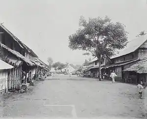
Straße in Bantaeng um 1900
Geographie
Bantaeng hat eine Fläche von 395,83 km². Hauptstadt ist Bantaeng.
Verwaltungsgliederung
Der Bezirk Bantaeng setzt sich aus acht administrativen Distrikten (Kecamatan) zusammen (Stand 2010):[1]
| Name | Bevölkerung Zensus 2010 |
|---|---|
| Bissappu | 30.931 |
| Uluere | 10.814 |
| Sinoa | 11.827 |
| Bantaeng | 36.718 |
| Eremerasa | 18.614 |
| Tompobulu | 22.913 |
| Pa'jukukang | 29.017 |
| Gantarangkeke | 15.865 |
Einzelnachweise
- Biro Pusat Statistik, Jakarta, 2011.

Verwaltungsgliederung der Provinz Sulawesi Selatan
Regierungsbezirk:
Bantaeng |
Barru |
Bone |
Bulukumba |
Enrekang |
Gowa |
Jeneponto |
Luwu |
Maros |
Nordluwu (Luwu Utara) |
Nordtoraja (Toraja Utara) |
Ostluwu (Luwu Timur) |
Pangkajene und Inseln (Pangkajene dan Kepulauan) |
Pinrang |
Salajarinseln (Kepulauan Selayar) |
Sidenreng Rappang |
Sinjai |
Soppeng |
Takalar |
Tana Toraja |
Wajo
Stadt:
Makassar |
Palopo |
Pare-Pare
This article is issued from Wikipedia. The text is licensed under Creative Commons - Attribution - Sharealike. The authors of the article are listed here. Additional terms may apply for the media files, click on images to show image meta data.