Regional District of Kootenay Boundary
Der Regional District of Kootenay Boundary ist ein Bezirk in der kanadischen Provinz British Columbia. Er ist 8.084,52 km² groß und zählt 31.447 Einwohner (2016).[1] Beim Zensus 2011 wurden 31.138 Einwohner ermittelt. Hauptort ist Trail.
| Kootenay Boundary | |
|---|---|
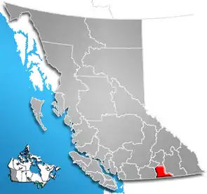 Lage der Region in British Columbia | |
| Basisdaten | |
| Staat | Kanada |
| Provinz | British Columbia |
| Verwaltungssitz | Trail |
| Koordinaten: | 49° 20′ N, 118° 45′ W |
| Einwohner | 31.447 (Stand: 2016) |
| Fläche | 8.084,52 km² |
| Bevölkerungsdichte | 3,9 Einw./km² |
| Zeitzone: | Pacific Standard Time (UTC−8) Pacific Daylight Time (UTC−7, Sommerzeit) |
| Webpräsenz | rdkb.com |
Der Bezirk wurde am 22. Februar 1966 gegründet.[2]
Administrative Gliederung
Städte und Gemeinden
| Ort | Status | Bevölkerung[3] |
| Fruitvale | Village | 1.920 |
| Grand Forks | City | 4.049 |
| Greenwood | City | 665 |
| Midway | Village | 649 |
| Montrose | Village | 996 |
| Rossland | City | 3.729 |
| Trail | City | 7.709 |
| Warfield | Village | 1.680 |
Gemeindefreie Gebiete
- Kootenay Boundary A
- Kootenay Boundary B
- Kootenay Boundary C
- Kootenay Boundary D
- Kootenay Boundary E
Weblinks
- Offizielle Seite
- Karte mit Grenzen herausgegeben von der Provinz (englisch)
Einzelnachweise
- Census Profile, 2016 Census. 16. November 2017, abgerufen am 13. März 2018 (englisch).
- Origin Notes and History. Regional District of Kootenay-Boundary. GeoBC, abgerufen am 15. Februar 2021 (englisch).
- Census Profile, 2016 Census - Provincial Data. 9. August 2019, abgerufen am 9. August 2019 (englisch).
Alberni-Clayoquot | Bulkley-Nechako | Capital | Cariboo | Central Coast | Central Kootenay | Central Okanagan | Columbia-Shuswap | Comox Valley | Cowichan Valley | East Kootenay | Fraser Valley | Fraser-Fort George | Kitimat-Stikine | Kootenay Boundary | Metro Vancouver | Mount Waddington | Nanaimo | North Coast | North Okanagan | Northern Rockies | Okanagan-Similkameen | Peace River | qathet | Squamish-Lillooet | Stikine | Strathcona | Sunshine Coast | Thompson-Nicola