Regional District of East Kootenay
Der Regional District of East Kootenay ist ein Bezirk in der kanadischen Provinz British Columbia. Er liegt im äußersten Südosten der Provinz, ist 27.541,84 km² groß und zählt 60.439 Einwohner (2016).[1] Beim Zensus 2011 wurden noch 56.685 Einwohner ermittelt. Hauptort ist Cranbrook.
| East Kootenay | |
|---|---|
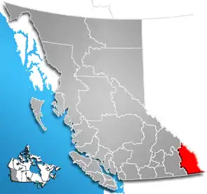 Lage der Region in British Columbia | |
| Basisdaten | |
| Staat | Kanada |
| Provinz | British Columbia |
| Verwaltungssitz | Cranbrook |
| Koordinaten: | 49° 55′ N, 115° 45′ W |
| Einwohner | 60.439 (Stand: 2016) |
| Fläche | 27.541,48 km² |
| Bevölkerungsdichte | 2,2 Einw./km² |
| Zeitzone: | Mountain Standard Time (UTC−7) Mountain Daylight Time (UTC−6, Sommerzeit) |
| Webpräsenz | www.rdek.bc.ca |
Abweichend vom überwiegenden Teil von British Columbia gilt im Regional District of East Kootenay nicht die Pacific Standard Time, sondern die Mountain Standard Time.
Administrative Gliederung
Städte und Gemeinden
| Ort | Status | Bevölkerung[2] |
| Cranbrook | City | 20.047 |
| Elkford | District municipality | 2.499 |
| Fernie | City | 5.249 |
| Invermere | District municipality | 3.391 |
| Kimberley | City | 7.425 |
| Radium Hot Springs | Village | 776 |
| Sparwood | District municipality | 3.784 |
Gemeindefreie Gebiete
- East Kootenay A
- East Kootenay B
- East Kootenay C
- East Kootenay D
- East Kootenay E
- East Kootenay F
Weblinks
- Offizielle Seite
- Karte mit Grenzen herausgegeben von der Provinz (englisch)
Einzelnachweise
- Census Profile, 2016 Census. 16. November 2017, abgerufen am 12. März 2018 (englisch).
- Census Profile, 2016 Census - Provincial Data. 9. August 2019, abgerufen am 9. August 2019 (englisch).
Alberni-Clayoquot | Bulkley-Nechako | Capital | Cariboo | Central Coast | Central Kootenay | Central Okanagan | Columbia-Shuswap | Comox Valley | Cowichan Valley | East Kootenay | Fraser Valley | Fraser-Fort George | Kitimat-Stikine | Kootenay Boundary | Metro Vancouver | Mount Waddington | Nanaimo | North Coast | North Okanagan | Northern Rockies | Okanagan-Similkameen | Peace River | qathet | Squamish-Lillooet | Stikine | Strathcona | Sunshine Coast | Thompson-Nicola