Red Mesa
Red Mesa ist ein Census-designated place im Apache County im US-Bundesstaat Arizona. Der Ort liegt in der Nähe der Four Corners.
| Red Mesa | |
|---|---|
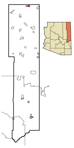 Lage im Apache County und in Arizona | |
| Basisdaten | |
| Staat: | Vereinigte Staaten |
| Bundesstaat: | Arizona |
| County: | Apache County |
| Koordinaten: | 36° 58′ N, 108° 23′ W |
| Einwohner: | 354 (Stand: 2020) |
| Fläche: | 32,9 km² (ca. 13 mi²) davon 32,9 km² (ca. 13 mi²) Land |
| Höhe: | 1635 m |
| Postleitzahl: | 86514 |
| Vorwahl: | +1 928 |
| FIPS: | 04-59550 |
| GNIS-ID: | 0024578 |
| Website: | redmesa.navajochapters.org |
Red Mesa hat 237 Einwohner auf einer Fläche von 32 km². Die Bevölkerungsdichte beträgt 7,2 Einwohner/km². Das Dorf liegt 1638 Meter hoch und befindet sich am U.S. Highway 160.
Weblinks
Commons: Red Mesa – Sammlung von Bildern, Videos und Audiodateien
This article is issued from Wikipedia. The text is licensed under Creative Commons - Attribution - Sharealike. The authors of the article are listed here. Additional terms may apply for the media files, click on images to show image meta data.