Pohuwato (Regierungsbezirk)
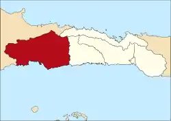
Pohuwato ist ein Regierungsbezirk (Kabupaten) auf der indonesischen Insel Sulawesi. Der Bezirk ist Teil der Provinz Gorontalo. Hier leben 128.771 Einwohner (2010).
| Kabupaten Pohuwato Regierungsbezirk Pohuwato | ||
|---|---|---|
 | ||
| Symbole | ||
| ||
| Basisdaten | ||
| Staat | Indonesien | |
| Provinz | Gorontalo | |
| Sitz | Marisa | |
| Fläche | 4.244,3 km² | |
| Einwohner | 128.771 (2010) | |
| Dichte | 30 Einwohner pro km² | |
| ISO 3166-2 | ID-GO | |
| Webauftritt | www.pohuwatokab.go.id (Indonesisch) | |
| Politik | ||
| Bupati | Haji Syarif Mbuinga, S.Pd,MM | |
Geographie
Pohuwato hat eine Fläche von 4.244,31 km². Hauptstadt ist Marisa.
Verwaltungsgliederung
Der Bezirk Pohuwato setzt sich aus 13 administrativen Distrikten (Kecamatan), drei Kelurahan und 79 Dörfern (Desa) zusammen (Stand 2010):[1]
| Distrikt | Bevölkerung Zensus 2010 |
|---|---|
| Popayato | 9.169 |
| Popatato Barat (West Popayato) | 6.670 |
| Popatato Timur (Ost Popayato) | 7.712 |
| Lemito | 10.488 |
| Wanggarasi | 4.573 |
| Marisa | 17.680 |
| Pantilanggio | 8.686 |
| Buntulia | 10.494 |
| Duhiadaa | 10.662 |
| Randangan | 14.995 |
| Taluditi | 7.248 |
| Paguat | 14.967 |
| Dengilo | 5.404 |
Einzelnachweise
- Biro Pusat Statistik, Jakarta, 2011.

Regierungsbezirk: Boalemo | Bone Bolango | Gorontalo | Gorontalo Utara | Pohuwato
Stadt: Kota Gorontalo
This article is issued from Wikipedia. The text is licensed under Creative Commons - Attribution - Sharealike. The authors of the article are listed here. Additional terms may apply for the media files, click on images to show image meta data.