Oshamambe (Hokkaidō)
Oshamanbe (jap. 長万部町 Oshamanbe-chō) ist ein japanischer Küstenort im Landkreis Yamakoshi in der Unterpräfektur Oshima auf Hokkaidō.
| Oshamanbe-chō 長万部町 | |||
|---|---|---|---|
 Oshamanbe | |||
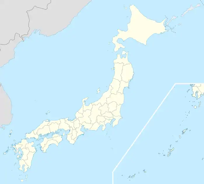
| Geographische Lage in Japan | |||
| |||
| Region: | Hokkaidō | ||
| Präfektur: | Hokkaidō | ||
| Koordinaten: | 42° 31′ N, 140° 23′ O | ||
| Basisdaten | |||
| Fläche: | 310,76 km² | ||
| Einwohner: | |||
| Gemeindeschlüssel: | 01347-1 | ||
| Symbole | |||
| Flagge/Wappen: |  | ||
| Baum: | Japanische Schwarzkiefer | ||
| Blüte: | Ostsibirische Schwertlilie | ||
| Rathaus | |||
| Adresse: | Oshamanbe Town Hall 453-1, Yamakoshi Oshamanbe-chō, Hokkaidō 049-3592 | ||
| Webadresse: | https://www.town.oshamambe.lg.jp/ | ||
| Lage der Stadt Oshamanbe in Hokkaidō | |||
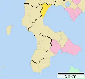 Lage Oshamanbes in der Präfektur | |||
Geographie
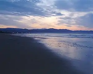
Oshamanbe liegt innerhalb der Uchiura-Bucht. Der größte Teil der Küste ist sandig und flach. Nordöstlich des Ortszentrums fließt der gleichnamige Oshamanbe in die Bucht.
Verkehr
Die Hokkaidō-Autobahn führt entlang der Bucht. Der Bahnhof Oshamanbe ist ein Halt der JR Hakodate-Hauptlinie und der Muroran-Hauptlinie.
Galerie
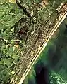 Luftbild Ortskern und Fluss, 1976
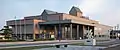 Rathaus von Oshamanbe
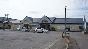 Bahnhof Oshamanbe
Weblinks
- Website von Oshamanbe (japanisch)
Abashiri | Akabira | Asahikawa | Ashibetsu | Bibai | Chitose | Date | Ebetsu | Eniwa | Fukagawa | Furano | Hakodate | Hokuto | Ishikari | Iwamizawa | Kitahiroshima | Kitami | Kushiro | Mikasa | Mombetsu | Muroran | Nayoro | Nemuro | Noboribetsu | Obihiro | Otaru | Rumoi | Sapporo (Verwaltungssitz) | Shibetsu | Sunagawa | Takikawa | Tomakomai | Utashinai | Wakkanai | Yūbari
Abashiri-gun: Ōzora | Bihoro | Tsubetsu | Abuta-gun: Toyoura | Tōyako | Niseko | Makkari | Rusutsu | Kimobetsu | Kyōgoku | Kutchan | Akan-gun: Tsurui | Akkeshi-gun: Akkeshi | Hamanaka | Ashoro-gun: Ashoro | Rikubetsu | Esashi-gun: Hamatombetsu | Nakatombetsu | Esashi | Furubira-gun: Furubira | Furuu-gun: Tomari | Kamoenai | Futami-gun: Yakumo | Hidaka-gun: Shinhidaka | Hiroo-gun: Taiki | Hiroo | Hiyama-gun: Esashi | Kaminokuni | Assabu | Horoizumi-gun: Erimo | Ishikari-gun: Tōbetsu | Shinshinotsu | Isoya-gun: Rankoshi | Iwanai-gun: Kyōwa | Iwanai | Kabato-gun: Tsukigata | Urausu | Shintotsukawa | Kameda-gun: Nanae | Kamiiso-gun: Shiriuchi | Kikonai | Kamikawa-gun (Ishikari): Takasu | Higashikagura | Tōma | Pippu | Aibetsu | Kamikawa | Higashikawa | Biei | Kamikawa-gun (Teshio): Wassamu | Kembuchi | Shimokawa | Kamikawa-gun (Tokachi): Shintoku | Shimizu | Kasai-gun: Memuro | Nakasatsunai | Sarabetsu | Katō-gun: Otofuke | Shihoro | Kamishihoro | Shikaoi | Kawakami-gun: Shibecha | Teshikaga | Kayabe-gun: Shikabe | Mori | Kudō-gun: Setana | Kushiro-gun: Kushiro | Mashike-gun: Mashike | Matsumae-gun: Matsumae | Fukushima | Menashi-gun: Rausu | Mombetsu-gun: Engaru | Yūbetsu | Takinoue | Okoppe | Nishiokoppe | Ōmu | Nakagawa-gun (Teshio): Bifuka | Otoineppu | Nakagawa | Nakagawa-gun (Tokachi): Makubetsu | Ikeda | Toyokoro | Honbetsu | Niikappu-gun: Niikappu | Nishi-gun: Otobe | Notsuke-gun: Betsukai | Okushiri-gun: Okushiri | Rebun-gun: Rebun | Rishiri-gun: Rishiri | Rishirifuji | Rumoi-gun: Obira | Samani-gun: Samani | Saru-gun: Biratori | Hidaka | Setana-gun: Imakane | Shakotan-gun: Shakotan | Shari-gun: Shari | Kiyosato | Koshimizu | Shibetsu-gun: Nakashibetsu | Shibetsu | Shimamaki-gun: Shimamaki | Shiranuka-gun: Shiranuka | Shiraoi-gun: Shiraoi | Sorachi-gun: Kamifurano | Kamisunagawa | Minamifurano | Naie | Nakafurano | Namporo | Sōya-gun: Sarufutsu | Suttsu-gun: Suttsu | Kuromatsunai | Teshio-gun: Embetsu | Teshio | Horonobe | Toyotomi | Tokachi-gun: Urahoro | Tokoro-gun: Kunneppu | Oketo | Saroma | Tomamae-gun: Tomamae | Haboro | Shosambetsu | Urakawa-gun: Urakawa | Uryū-gun: Moseushi | Chippubetsu | Uryū | Hokuryū | Numata | Horokanai | Usu-gun: Sōbetsu | Yamakoshi-gun: Oshamambe | Yoichi-gun: Niki | Yoichi | Akaigawa | Yūbari-gun: Yuni | Naganuma | Kuriyama | Yūfutsu-gun: Abira | Atsuma | Mukawa | Shimukappu