Ngatpang
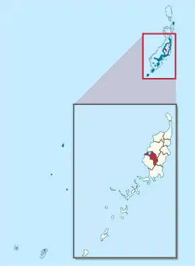
Ngatpang ist ein administrativer Staat (d. h. ein Verwaltungsgebiet) der pazifischen Inselrepublik Palau. Der 47 km² große Teilstaat liegt im Westen der Hauptinsel Babelthuap an der Ngeremeduu Bay und der Halbinsel Ngereklmadel. Er besteht aus den drei Dörfern (hamlets) Ibobang, Mechebechubel (Ngereklmadel) und Nekkeng. Die Hauptstadt von Ngatpang ist Ngatpang Village oder Nekkeng[1], 2015 lebten dort 282 Menschen.[2] Das in einigen Quellen als Hauptort angegebene Oikull liegt im Staat Airai.[3]
| Ngatpang | |
|---|---|
 | |
| Geographie | |
| Staat: | Palau |
| Gewässer: | Pazifischer Ozean |
| Inseln: | Babelthuap |
| Geographische Lage: | 7° 29′ N, 134° 31′ O |
| Basisdaten | |
| Fläche: | 47 km² |
| Einwohner: | 282 |
| Bevölkerungsdichte: | 6 Einw./km² |
| Hauptstadt: | Ngatpang Village oder Nekkeng |
| Lagekarte | |
 | |
Weblinks
- Constitution of the State of Ngatpang (englisch)
Einzelnachweise
- Pacific Adaptation to Climate Change (englisch), S. 13 (PDF; 274 kB).
- 2015 Census of Population, Housing and Agriculture for the Republic of Palau. Office of Planning and Statistics, 2017.
- Constitution of the State of Airai (englisch), s. Art. 1. (Memento des Originals vom 9. Oktober 2017 im Internet Archive) Info: Der Archivlink wurde automatisch eingesetzt und noch nicht geprüft. Bitte prüfe Original- und Archivlink gemäß Anleitung und entferne dann diesen Hinweis.
Staaten von Palau
This article is issued from Wikipedia. The text is licensed under Creative Commons - Attribution - Sharealike. The authors of the article are listed here. Additional terms may apply for the media files, click on images to show image meta data.