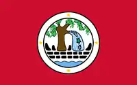
Ngiwal
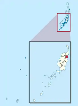
Ngival ist ein administrativer Staat (d. h. ein Verwaltungsgebiet) der pazifischen Inselrepublik Palau. Der aus den Dörfern (hamlets) Ngelau, dem Hauptort Ngercheluuk und Ngermechau[1] bestehende 26 km² große Teilstaat liegt im Osten der Hauptinsel Babeldaob. 2015 lebten dort 282 Menschen.[2]
| Ngiwal | |
|---|---|
 | |
| Geographie | |
| Staat: | Palau |
| Gewässer: | Pazifischer Ozean |
| Inseln: | Babeldaob |
| Geographische Lage: | 7° 33′ N, 134° 37′ O |
| Basisdaten | |
| Fläche: | 26 km² |
| Einwohner: | 282 |
| Bevölkerungsdichte: | 11 Einw./km² |
| Hauptstadt: | Ngercheluuk |
| Lagekarte | |
 | |
Einzelnachweise
- Constitution of Ngiwal State (englisch)
- 2015 Census of Population, Housing and Agriculture for the Republic of Palau. Office of Planning and Statistics, 2017.
Staaten von Palau
This article is issued from Wikipedia. The text is licensed under Creative Commons - Attribution - Sharealike. The authors of the article are listed here. Additional terms may apply for the media files, click on images to show image meta data.