McClintock-Kanal
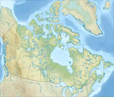
Der McClintock-Kanal (englisch M'Clintock Channel) ist ein Ausläufer des Arktischen Ozeans im kanadischen Territorium Nunavut. Er liegt im kanadisch-arktischen Archipel, zwischen der Victoria-Insel und der Prince-of-Wales-Insel. Der Kanal ist 274 km lang sowie 105 bis 209 km breit und verbindet den Viscount-Melville-Sund im Norden mit dem Larsensund im Süden.
| McClintock-Kanal | ||
|---|---|---|
| Verbindet Gewässer | Viscount-Melville-Sund | |
| mit Gewässer | Larsensund | |
| Trennt Landmasse | Prince-of-Wales-Insel | |
| von Landmasse | Victoria-Insel | |
| Daten | ||
| Geographische Lage | 71° 41′ N, 102° 13′ W | |
| ||
| Länge | 271 km | |
| Geringste Breite | 105 km | |
| Inseln | Gateshead Island | |
Benannt wurde die Meeresstraße nach dem Polarforscher Francis McClintock und gehörte zum ehemaligen Franklin-Distrikt.
Alexandra Strait | Arnott Strait | Austin Channel | Barrow Strait | Beare Sound | Belcher-Kanal | Bellotstraße | Boyer Strait | Byam Channel | Byam Martin Channel | Cardigan Strait | Clarke Sound | Comer Strait | Coronation Gulf | Crozier Strait | Danish Strait | Davisstraße | Dease Strait | Desbarats Strait | Digges Sound | Dolphin and Union Strait | Erskine Inlet | Eureka Sound | Evans Strait | Fisher Strait | Foxe-Kanal | Franklin Strait | Frozen Strait | Fury-und-Hecla-Straße | Glacier Strait | Goldsmith Channel | Hall-Becken | Hassel Sound | Hazen Strait | Hendriksen Strait | Hoppner Strait | Hudsonstraße | Humboldt Channel | James Ross Strait | Jonessund | Kennedy-Kanal | Lady Ann Strait | Lancastersund | Larsen Sound | Maclean Strait | Massey Sound | Maury Channel | McClintock-Kanal | McDougall-Sund | Melvillesund | Nansen Sound | Nares-Straße | Parry Channel | Pearse Strait | Peary Channel | Peel Sound | Penny Strait | Prince Regent Inlet | Pullen Strait | Queen Maud Gulf | Queens Channel | Rae Strait | Rasmussen Basin | Rice Strait | Robeson-Kanal | Roes Welcome Sound | Simpson Strait | Sir William Parker Strait | Smithsund | Sverdrup-Kanal | Tasiujaq | Victoria Strait | Viscount-Melville-Sund | Wellington Channel | Wellington Strait | Wilkins Strait