Lysá pod Makytou
Lysá pod Makytou (slowak. „Lysá unter der Makyta“, bis 1927 nur „Lysá“; ungarisch Fehérhalom – bis 1902 Lissza oder älter Lisza) ist eine Gemeinde in der Nordwestslowakei. Sie liegt im Tal des Flusses Biela voda unterhalb des Lissapasses zwischen den Weißen Karpaten und dem Javorník-Gebirge, etwa 15 km von Púchov in der Slowakei und 32 km von tschechischen Vsetín entfernt.
| Lysá pod Makytou | |||
|---|---|---|---|
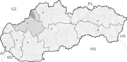
| Wappen | Karte | ||
 |
| ||
| Basisdaten | |||
| Staat: | Slowakei | ||
| Kraj: | Trenčiansky kraj | ||
| Okres: | Púchov | ||
| Region: | Stredné Považie | ||
| Fläche: | 33,402 km² | ||
| Einwohner: | 2.051 (31. Dez. 2020) | ||
| Bevölkerungsdichte: | 61 Einwohner je km² | ||
| Höhe: | 365 m n.m. | ||
| Postleitzahl: | 020 54 | ||
| Telefonvorwahl: | 0 42 | ||
| Geographische Lage: | 49° 12′ N, 18° 12′ O | ||
| Kfz-Kennzeichen: | PU | ||
| Kód obce: | 513342 | ||
| Struktur | |||
| Gemeindeart: | Gemeinde | ||
| Gliederung Gemeindegebiet: | 3 Gemeindeteile | ||
| Verwaltung (Stand: November 2018) | |||
| Bürgermeister: | Michal Ondrička | ||
| Adresse: | Obecný úrad Lysá pod Makytou 1 02054 Lysá pod Makytou | ||
| Webpräsenz: | www.lysapodmakytou.sk | ||
| Statistikinformation auf statistics.sk | |||
Die erste schriftliche Erwähnung erfolgte 1471 als Lyzsa. Zur Gemeinde gehören auch Gemeindeteile Dešná und Strelenka.
Im Gemeindeteil Strelenka besteht ein Straßen- und Eisenbahngrenzübergang (Bahnstrecke Púchov–Horní Lideč) zu Tschechien (Gemeinde Střelná).
This article is issued from Wikipedia. The text is licensed under Creative Commons - Attribution - Sharealike. The authors of the article are listed here. Additional terms may apply for the media files, click on images to show image meta data.