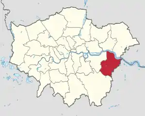
London Borough of Bexley
Der London Borough of Bexley [ˈbɛksli] ist ein Stadtbezirk von London. Er liegt im Osten der Stadt. Bei der Gründung der Verwaltungsregion Greater London im Jahr 1965 entstand er aus folgenden Gemeinden der Grafschaft Kent: Municipal Borough of Bexley, Municipal Borough of Erith, Crayford Urban District und ein Teil des Chislehurst and Sidcup Urban District.
| London Borough of Bexley | |
|---|---|
 Bexley | |
| Status | London Borough |
| Region | Greater London |
| Verwaltungssitz | Bexleyheath |
| Fläche | 60,56 km² |
| Einwohner | 247.258 |
| Stand | 30. Juni 2018[1] |
| ONS-Code | 00AD |
| Website | www.bexley.gov.uk |
Städtepartnerschaften
 Arnsberg in Deutschland
.svg.png.webp) Évry in Frankreich
Évry in Frankreich
Stadtteile
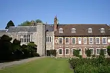
HallPlace
- Albany Park
- Barnehurst
- Barnes Cray
- Belvedere
- Bexley
- Bexleyheath *
- Blackfen
- Blendon
- Bostall
- Bridgen
- Coldblow
- Crayford
- Crook Log
- East Wickham
- Erith *
- Falconwood
- Foots Cray
- Lamorbey
- Lessness Heath
- Longlands
- May Place
- North Cray
- North End
- Northumberland Heath
- Ruxley
- Sidcup
- Slade Green
- Thamesmead *
- Upper Belvedere
- Upton
- Welling
- West Heath *
* - Zu entsprechenden Stadtteilen gibt es noch keine eigenen Artikel, nur Weiterleitungen hierher.
Wahlkreise
Persönlichkeiten
- Stephanie Brind (* 1977), Squashspielerin
- Kate Bush (* 1958), Sängerin
- Wendy Cope (* 1945), Dichterin
- Boy George (* 1961), Sänger, DJ
- Jacqueline Jossa (* 1992), Schauspielerin
- Robert Knox (1989–2008), Schauspieler
- Joseph Lister, 1. Baron Lister (1827–1912), Mediziner
- Colin Seeley (1936–2020), Motorradrennfahrer und Motorradhersteller
Weblinks
Commons: London Borough of Bexley – Sammlung von Bildern, Videos und Audiodateien
- Bexley Borough Council (Bezirksverwaltung)
Einzelnachweise
This article is issued from Wikipedia. The text is licensed under Creative Commons - Attribution - Sharealike. The authors of the article are listed here. Additional terms may apply for the media files, click on images to show image meta data.