La Clotte
La Clotte ist eine südwestfranzösische Gemeinde mit 717 Einwohnern (Stand 1. Januar 2019) im Département Charente-Maritime in der Region Nouvelle-Aquitaine (vor 2016 Poitou-Charentes). Die Gemeinde gehört zum Arrondissement Jonzac und zum Kanton Les Trois Monts (bis 2015 Montguyon). Die Einwohner werden Clottois genannt.
| La Clotte | ||
|---|---|---|
| ||
| Staat | Frankreich | |
| Region | Nouvelle-Aquitaine | |
| Département (Nr.) | Charente-Maritime (17) | |
| Arrondissement | Jonzac | |
| Kanton | Les Trois Monts | |
| Gemeindeverband | Haute-Saintonge | |
| Koordinaten | 45° 7′ N, 0° 9′ W | |
| Höhe | 12–73 m | |
| Fläche | 17,90 km² | |
| Einwohner | 717 (1. Januar 2019) | |
| Bevölkerungsdichte | 40 Einw./km² | |
| Postleitzahl | 17360 | |
| INSEE-Code | 17113 | |
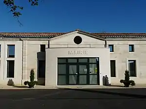 Rathaus von La Clotte | ||

Lage
La Clotte liegt im Süden der Saintonge etwa 45 Kilometer nordöstlich von Bordeaux am Lary. Umgeben wird La Clotte von den Nachbargemeinden Saint-Pierre-du-Palais im Norden, Saint-Martin-de-Coux im Norden und Nordosten, Chamadelle im Osten, Lagorce im Süden sowie Cercoux im Westen.
Bevölkerungsentwicklung
| Jahr | 1962 | 1968 | 1975 | 1982 | 1990 | 1999 | 2008 | 2013 |
| Einwohner | 521 | 484 | 499 | 475 | 475 | 490 | 531 | 697 |
| Quelle: Cassini und INSEE | ||||||||
Sehenswürdigkeiten
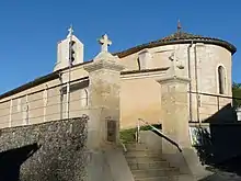
Kirche Saint-Léger
- Kirche Saint-Léger
- Reste einer Turmhügelburg
Literatur
- Le Patrimoine des Communes de la Charente-Maritime. Flohic Editions, Band 1, Paris 2002, ISBN 2-84234-129-5, S. 519–520.
This article is issued from Wikipedia. The text is licensed under Creative Commons - Attribution - Sharealike. The authors of the article are listed here. Additional terms may apply for the media files, click on images to show image meta data.